Skip navigation
Home
Browse
Collections
Browse Items by:
Corporate Author
Author
Title Holder/Company
Subject
1:100k mapsheet
1:250k mapsheet
Drillhole
Geological Province
Mine or Prospect
Document Type
Map Scale
Bottom Hole Formation
Survey Name
Stratigraphic Name
Contact Us
Download
Request
Help
Sign on to:
GEMIS
Receive email
updates
Edit Profile
GEMIS
Search
Search:
All Collections
NTGS Products
AGES abstracts and other papers
Digital Information Packages
Geophysical and Remote Sensing Data
HyLogger Data
Maps and Explanatory Notes
Reports, Records, Books
for
Current filters:
Report ID
Document Type
Author
Title
Drillhole
Mine or Prospect
Subject
Title Holder/Company
Abstract
Tenure
Stratigraphy
GIS version
Geological Province
Map250
Map100
Year
Collection
Publisher
Date Added
Equals
Contains
ID
Not Equals
Not Contains
Not ID
Report ID
Document Type
Author
Title
Drillhole
Mine or Prospect
Subject
Title Holder/Company
Abstract
Tenure
Stratigraphy
GIS version
Geological Province
Map250
Map100
Year
Collection
Publisher
Date Added
Equals
Contains
ID
Not Equals
Not Contains
Not ID
Start a new search
Add filters:
Use filters to refine the search results.
Report ID
Document Type
Author
Title
Drillhole
Mine or Prospect
Subject
Title Holder/Company
Abstract
Tenure
Stratigraphy
GIS version
Geological Province
Map250
Map100
Year
Collection
Publisher
Date Added
Equals
Contains
ID
Not Equals
Not Contains
Not ID
Results 1-10 of 41 (Search time: 0.0 seconds).
previous
1
2
3
4
...
5
next
Item hits:
Year
Title
Title Holder/Company
Report id
Preview
Download
2022
Summary of results. NTGS LA-ICP-MS U-Pb-Hf geochronology project: selected samples from HUCKITTA 1:250 000 mapsheet, May 2011-October 2018
-
NTGS Record 2022-007
1 file
2021
Epigenetic copper and tungsten mineralisation in the northeastern Aileron Province, central Australia
-
-
2 files
2020
Mount Peake, Northern Territory : sheet SF5301
-
-
4 files
2020
HyLogger drillhole report for APDD002, Aileron Province, Northern Territory
-
HDP0084
1 file
2020
NTGS Mount Peake - Crawford: magnetics and radiometrics survey
-
-
5 files
2020
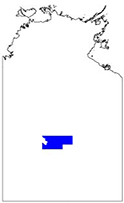
Summary of results. Joint NTGS-GA geochronology project: central and western Aileron Province
-
NTGS Record 2020-011
1 file
2020
New geophysical and remote sensed data in the Northern Territory: 2019
-
-
2 files
2022
The application of geophysics in the discovery of brownfields' copper mineralisation at Jervois, Northern Territory
-
-
2 files
2020
Summary of results. Joint NTGS-GA geochronology project: Aileron and Irindina provinces, Jinka and Dneiper 1:100 000 mapsheets, 2019
-
NTGS Record 2020-001
1 file
2022
Mafic igneous stratigraphy and potential for orthomagmatic Ni-Cu-PGE and VMS Cu-Co mineralisation in the Irindina Province, central Australia
-
-
2 files
Discover
Collection
20
AGES abstracts and other papers
3
Digital Information Packages
1
Geophysical and Remote Sensing Data
4
HyLogger Data
3
Maps and Explanatory Notes
10
Reports, Records, Books
Document Type
15
Presentation
14
AGES Abstract
13
NTGS Record
5
GIS Data
4
HyLogger Data Package
3
Conference Proceedings
3
NTGS Digital Information Package
1
100k Geological Map
1
250k Geological Map
1
Airborne Magnetic and Radiometric...
.
next >
Geological Province
37
Aileron Province
10
Amadeus Basin
5
Arnhem Province
9
Beetaloo Sub-basin
2
Birrindudu Basin
2
Canning Basin
3
Carpentaria Basin
2
Carrara Sub-basin
1
Davenport Province
1
Eromanga Basin
.
next >
Map 250
2
Highland Rocks SF5207
11
Huckitta SF5311
2
Illogwa Creek SF5315
1
Lander River SF5301
1
Mount Doreen SF5212
.
< previous
next >
Map 100
2
Anningie 5554
1
Chilla 5054
1
Conical Hill 5555
1
Delny 5852
1
Denison 5353
.
next >
Year
10
2022
14
2021
17
2020