Skip navigation
Home
Browse
Collections
Browse Items by:
Corporate Author
Author
Title Holder/Company
Subject
1:100k mapsheet
1:250k mapsheet
Drillhole
Geological Province
Mine or Prospect
Document Type
Map Scale
Bottom Hole Formation
Survey Name
Stratigraphic Name
Contact Us
Download
Request
Help
Sign on to:
GEMIS
Receive email
updates
Edit Profile
GEMIS
Search
Search:
All Collections
NTGS Products
AGES abstracts and other papers
Digital Information Packages
Geophysical and Remote Sensing Data
HyLogger Data
Maps and Explanatory Notes
Reports, Records, Books
for
Current filters:
Report ID
Document Type
Author
Title
Drillhole
Mine or Prospect
Subject
Title Holder/Company
Abstract
Tenure
Stratigraphy
GIS version
Geological Province
Map250
Map100
Year
Collection
Publisher
Date Added
Equals
Contains
ID
Not Equals
Not Contains
Not ID
Report ID
Document Type
Author
Title
Drillhole
Mine or Prospect
Subject
Title Holder/Company
Abstract
Tenure
Stratigraphy
GIS version
Geological Province
Map250
Map100
Year
Collection
Publisher
Date Added
Equals
Contains
ID
Not Equals
Not Contains
Not ID
Start a new search
Add filters:
Use filters to refine the search results.
Report ID
Document Type
Author
Title
Drillhole
Mine or Prospect
Subject
Title Holder/Company
Abstract
Tenure
Stratigraphy
GIS version
Geological Province
Map250
Map100
Year
Collection
Publisher
Date Added
Equals
Contains
ID
Not Equals
Not Contains
Not ID
Results 1-10 of 58 (Search time: 0.002 seconds).
previous
1
2
3
4
...
6
next
Item hits:
Year
Title
Title Holder/Company
Report id
Preview
Download
2018
Batten Fault Zone : gravity survey
-
-
2 files
2018
Secrets from the deep: greater McArthur Basin SEEBASE study helps unravel evolution of the basin and its underlying basement
-
-
2 files
2018
Positive Traditional Owner engagement - A case study from West Arnhem Land
-
-
2 files
2018
Summary of results. NTGS LA-ICP-MS geochronology project: Nimbuwah Domain, Pine Creek Orogen, December 2015
-
NTGS Record 2018-004
1 file
2018
Exploring for the Future opportunities beneath the Tennant Creek-Mount Isa (TISA) region
-
-
2 files
2018
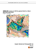
SEEBASE Study and GIS for greater McArthur Basin: Supplementary Data
-
DIP018
4 files
2018
Annual Geoscience Exploration Seminar (AGES) proceedings, Alice Springs, Northern Territory 20 - 21 March 2018
-
-
1 file
2018
Seismic shift in regional Neoproterozoic correlation, Amadeus Basin, central Australia
-
-
2 files
2018
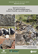
Summary of results. Joint NTGS-GA geochronology project: Arnhem Province, July 2014-June 2016
-
NTGS Record 2017-008
1 file
2018
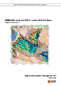
SEEBASE Study and GIS for greater McArthur Basin
-
DIP017
3 files
Discover
Collection
29
AGES abstracts and other papers
3
Digital Information Packages
2
Geophysical and Remote Sensing Data
6
HyLogger Data
2
Maps and Explanatory Notes
16
Reports, Records, Books
Document Type
26
Presentation
25
AGES Abstract
17
NTGS Record
5
HyLogger Data Package
3
GIS Data
3
NTGS Digital Information Package
1
Airborne Magnetic and Radiometric...
1
Conference Proceedings
1
Core Analysis
1
Gravity Survey
.
next >
Geological Province
13
Aileron Province
13
Amadeus Basin
1
Arafura Basin
6
Arnhem Province
11
Arunta Region
8
Beetaloo Sub-basin
1
Birrindudu Basin
1
Bonaparte Basin
1
Browse Basin
1
Carpentaria Basin
.
next >
Map 250
4
Huckitta SF5311
1
Katherine SD5309
1
Mount Doreen SF5212
1
Mount Drummond SE5312
1
Mount Rennie SF5215
.
< previous
next >
Map 100
1
Adam 6451
1
Areyonga 5349
1
Blue Mud Bay 6070
1
Borroloola 6165
1
Caledon 6272
.
next >