Skip navigation
Home
Browse
Collections
Browse Items by:
Corporate Author
Author
Title Holder/Company
Subject
1:100k mapsheet
1:250k mapsheet
Drillhole
Geological Province
Mine or Prospect
Document Type
Map Scale
Bottom Hole Formation
Survey Name
Stratigraphic Name
Contact Us
Download
Request
Help
Sign on to:
GEMIS
Receive email
updates
Edit Profile
GEMIS
Search
Search:
All Collections
NTGS Products
AGES abstracts and other papers
Digital Information Packages
Geophysical and Remote Sensing Data
HyLogger Data
Maps and Explanatory Notes
Reports, Records, Books
for
Current filters:
Report ID
Document Type
Author
Title
Drillhole
Mine or Prospect
Subject
Title Holder/Company
Abstract
Tenure
Stratigraphy
GIS version
Geological Province
Map250
Map100
Year
Collection
Publisher
Date Added
Equals
Contains
ID
Not Equals
Not Contains
Not ID
Start a new search
Add filters:
Use filters to refine the search results.
Report ID
Document Type
Author
Title
Drillhole
Mine or Prospect
Subject
Title Holder/Company
Abstract
Tenure
Stratigraphy
GIS version
Geological Province
Map250
Map100
Year
Collection
Publisher
Date Added
Equals
Contains
ID
Not Equals
Not Contains
Not ID
Results 1-50 of 136 (Search time: 0.004 seconds).
previous
1
2
3
next
Item hits:
Year
Title
Title Holder/Company
Report id
Preview
Download
2021
Geological interpretation and structural analysis of the northwest Aileron and southwest Davenport provinces
-
DIP035
3 files
2020
South Nicholson Gravity Survey GA P201701 CSCBA267GU
-
-
2021
X-ray diffraction data of shales from the greater McArthur Basin
-
NTGS Record 2021-010
1 file
2021
CSIRO-NTGS McArthur Basin Project: analysis and interpretation of historical AEM data sets
-
DIP033
3 files
2021
Summary of results. NTGS LA-ICP-MS Hf program: Amadeus Basin, 2015
-
NTGS Record 2021-009
1 file
2021
Summary of results. Joint NTGS-GA geochronology project: Rover mineral field, Warramunga Province, January-June 2020
-
NTGS Record 2021-003
1 file
2021
Lithology and petrology of drillhole TDD001, Bluebush area, Warramunga Province
-
NTGS Record 2021-006
1 file
2021
Summary of results. Joint NTGS-GA geochronology project: Aileron Province, Jinka and Dneiper 1:100 000 mapsheets, 2020
-
NTGS Record 2021-008
1 file
2021
Lithology and petrology of the Rover field, Warramunga Province: Selected unmineralised drill core
-
NTGS Record 2021-005
1 file
2021
Geophysical interpretation of the Tanami Region, northern Aileron and southwest Davenport provinces
-
-
1 file
2021
Summary of results. Laser ablation ICP-MS in situ apatite geochronology of the Molyhil tungsten-molybdenum deposit and Prospect D nickel-copper prospect
-
NTGS Record 2021-007
1 file
2021
HyLogger drillhole report for RNRCD029, 'Anomaly 11', Pine Creek Orogen, Northern Territory
-
HDP0105
2 files
2021
Processed HyLogger data for NDI Carrara 1, MinEx CRC National Drilling Initiative South Nicholson Campaign, Northern Territory
-
-
1 file
2021
National Drilling Initiative - delivering exciting results
-
-
1 file
2021
Natural Fractures and the Kyalla
-
-
1 file
2021
HyLogger drillhole report for NDIBK07, MinEx CRC National Drilling Initiative, Campaign 1 East Tennant, Northern Territory
-
HDP0108
2 files
2021
HyLogger drillhole report for HYDD100054, 'Suplejack fault' Tanami Region, Northern Territory
-
HDP0106
2 files
2021
HyLogger drillhole report for NDIBK10, MinEx CRC National Drilling Initiative, Campaign 1 East Tennant, Northern Territory
-
HDP0107
3 files
2021
Annual Geoscience Exploration Seminar (AGES). Presentations and posters
-
NTGS Record 2021-004
1 file
2021
The Exploring for the Future 2019 Barkly 2D Deep Crustal Reflection Seismic Survey: key discoveries and implication for resources
-
-
2 files
2021
The Rover field: insights on stratigraphy, age and base metal mineralisation
-
-
2 files
2021
Revising the igneous stratigraphy in the eastern Aileron Province: implications for the geodynamic setting between ca 1.81-1.71 Ga
-
-
2 files
2021
Kalkarindji through the geophysical lens: structural characteristics of the Kalkarindji basalt from non-seismic geophysical data
-
-
2 files
2021
Petroleum geology and geochemistry of the Birrindudu Basin, greater McArthur Basin
-
-
2 files
2021
The Northern Territory SEEBASE: an updated, Territory-wide depth-to-basement model for explorers
-
-
2 files
2021
Warramunga Province Deposit Atlas program: an update
-
-
2 files
2021
Resource model update for the Fountain Head Gold Project, Pine Creek Orogen, Northern Territory
-
-
2 files
2021
Targeting sediment-hosted stratiform copper deposits in the Northern Territory
-
-
2 files
2021
Application of gravity to the Finniss Lithium Project
-
-
2 files
2021
Exploration potential of the Jervois mineral field
-
-
2 files
2021
Semi-supervised lithogeochemical classification of the Tanami Group
-
-
2 files
2021
Alteration mineral mapping at Rover 1 using Short Wave InfraRed spectroscopy
-
-
2 files
2021
Epigenetic copper and tungsten mineralisation in the northeastern Aileron Province, central Australia
-
-
2 files
2021
Improving access to geoscience information: recent highlights
-
-
2 files
2021
New constraints on the timing of metamorphism, deformation, and base metal mineralisation in the Aileron Province
-
-
2 files
2021
Results from the MinEx CRC National Drilling Initiative campaign in East Tennant: What's there and why you should care
-
-
2 files
2021
Highlights of mineral and petroleum exploration and development in 2020
-
-
2 files
2021
Update on geological mapping in the central and western Amadeus Basin
-
-
2 files
2021
Resourcing the Territory initiative: precompetitive geoscience across the Territory
-
-
2 files
2021
New geophysical and remote sensed data in the Northern Territory: 2020
-
-
2 files
2021
Unlocking the eastern extension of the Beetaloo Sub-basin middle Velkerri shales
-
-
2 files
2021
Solid geological interpretation and structural analysis of the Tanami Region and northwest Aileron Province: insights from newly acquired regional aeromagnetic surveys
-
-
2 files
2021
Compilation of industry geophysical data over the Tennant Creek and Rover mineral fields
-
DIP032
13 files
2021
Summary of results. Joint NTGS-GA geochronology project: western Amadeus Basin, July-August 2020
-
NTGS Record 2021-002
1 file
2021
Annual Geoscience Exploration Seminar (AGES) Proceedings, Alice Springs, Northern Territory, 20-21 April 2021
-
-
1 file
2021
CSIRO-NTGS Tanami Project: aeromagnetic interpretation of the Tanami Region - GIS
-
DIP021
4 files
2021
CSIRO-NTGS Tanami Project: aeromagnetic interpretation of the Tanami Region - Geophysical Data
-
DIP022
3 files
2020
HyLogger drillhole report for 14MCDDH002, McArthur Basin, Northern Territory
-
HDP0099
2 files
2021
West Amadeus Basin, Northern Territory : explanatory notes
-
-
1 file
2021
West Amadeus Basin : interpreted geology, Northern Territory
-
-
4 files
Results 1-50 of 136 (Search time: 0.004 seconds).
previous
1
2
3
next
Discover
Collection
56
AGES abstracts and other papers
13
Digital Information Packages
7
Geophysical and Remote Sensing Data
34
HyLogger Data
6
Maps and Explanatory Notes
20
Reports, Records, Books
Document Type
50
AGES Abstract
35
Presentation
28
HyLogger Data Package
22
NTGS Record
14
GIS Data
13
NTGS Digital Information Package
6
Airborne Magnetic and Radiometric...
6
Processed HyLogger data
3
Gravity Survey
2
Conference Proceedings
.
next >
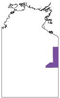
Geological Province
30
Aileron Province
18
Amadeus Basin
4
Arnhem Province
31
Arunta Region
15
Beetaloo Sub-basin
5
Birrindudu Basin
3
Canning Basin
2
Carpentaria Basin
3
Daly Basin
2
Davenport Province
.
next >
Map 250
1
Alcoota SF5310
1
Alice Springs SF5314
4
Alligator River SD5301
8
Alroy SE5315
1
Arnhem Bay SD5303
.
next >
Map 100
3
Alroy 6159
2
Anningie 5554
1
Arapunga 6053
1
Arnhem 6173
1
Barkly 5859
.
next >
Year
56
2021
80
2020