Skip navigation
Home
Browse
Collections
Browse Items by:
Corporate Author
Author
Title Holder/Company
Subject
1:100k mapsheet
1:250k mapsheet
Drillhole
Geological Province
Mine or Prospect
Document Type
Map Scale
Bottom Hole Formation
Survey Name
Stratigraphic Name
Contact Us
Download
Request
Help
Sign on to:
GEMIS
Receive email
updates
Edit Profile
GEMIS
Search
Search:
All Collections
NTGS Products
AGES abstracts and other papers
Digital Information Packages
Geophysical and Remote Sensing Data
HyLogger Data
Maps and Explanatory Notes
Reports, Records, Books
for
Current filters:
Report ID
Document Type
Author
Title
Drillhole
Mine or Prospect
Subject
Title Holder/Company
Abstract
Tenure
Stratigraphy
GIS version
Geological Province
Map250
Map100
Year
Collection
Publisher
Date Added
Equals
Contains
ID
Not Equals
Not Contains
Not ID
Start a new search
Add filters:
Use filters to refine the search results.
Report ID
Document Type
Author
Title
Drillhole
Mine or Prospect
Subject
Title Holder/Company
Abstract
Tenure
Stratigraphy
GIS version
Geological Province
Map250
Map100
Year
Collection
Publisher
Date Added
Equals
Contains
ID
Not Equals
Not Contains
Not ID
Results 1-50 of 409 (Search time: 0.003 seconds).
previous
1
2
3
4
...
9
next
Item hits:
Year
Title
Title Holder/Company
Report id
Preview
Download
2002
Detailed wellsite logs for 99VRNTGSDD1 and 99VRNTGSDD2, Victoria River Basin, Northern Territory
-
NTGS Technical Note 2002-016
1 file
2004
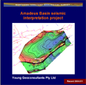
Amadeus Basin seismic interpretation project
-
NTGS Record 2004-011
2 files
1999
Landsat 7 : NT Scene 104/68-104/69- 105/69 mosaic
-
-
2007
1:250 000 geological map series BMR explanatory notes of the Northern Territory: compilation
-
NTGS Special Publication 3
1 file
2000
Amadeus Central : magnetics and radiometrics survey
-
-
2 files
2000
Tanami, Northern Territory : sheet 4858
-
-
1 file
2001
Pargee, Northern Territory : sheet 4758
-
-
1 file
2001
Tanami, Northern Territory : interpreted geology
-
-
1 file
2000
Pargee, Northern Territory : interpreted geology
-
-
1 file
2007
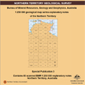
1:100 000 geological map series BMR explanatory notes of the Northern Territory: compilation
-
NTGS Special Publication 4
1 file
2001
Waterloo : magnetics and radiometrics survey
-
-
2 files
2000
West Arnhem : magnetics and radiometrics survey
-
-
2 files
2007
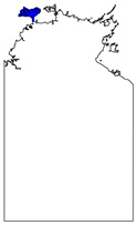
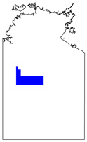
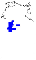
Phosphate testing of waterbores and diamond drillcore in the Georgina, Wiso and Daly basins, Northern Territory
-
NTGS Record 2007-003
1 file
2006
Tiwi Islands : magnetics and radiometrics survey
-
-
4 files
2000
Wiso : magnetics and radiometrics survey
-
-
4 files
2002
Buchanan : magnetics and radiometrics survey
-
-
4 files
2004
Simpson : magnetics and radiometrics survey
-
-
6 files
2001
Eromanga : magnetics and radiometrics survey
-
-
4 files
2002
Georgina : magnetics and radiometrics survey
-
-
4 files
2007
Tanumbirini : magnetics and radiometrics survey
-
-
4 files
2001
Barkly : magnetics and radiometrics survey
-
-
3 files
2004
Jervois : magnetics and radiometrics survey
-
-
2 files
2000
Mary River : magnetics and radiometrics survey
-
-
2 files
2008
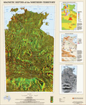
Magnetic depths of the Northern Territory
-
-
1 file
2001
Sturt : magnetics and radiometrics survey
-
-
2 files
2000
Bauhinia : magnetics and radiometrics survey
-
-
2 files
2003
Base metal mineralisation in the Strangways Metamorphic Complex, Arunta Region, Australia: variations on a theme and/or different mineralisation styles
-
-
2000
Tanami Region geochemical dataset
-
NTGS Record 2000-014
1 file
2000
Landsat 7 : NT Scene 104/69 (29/08/99)
-
-
1 file
2006
Western Pine Creek Orogen (Litchfield Province) recent advances and regional correlations
-
-
2002
1:500 000-scale integrated mapped and interpreted geology of the Tennant Inlier
-
-
2000
Gold mineralisation of the Tanami Region
-
-
2002
Broken Hill and Mount Isa age terrains on the southern margin of the North Australian Craton
-
-
2009
Extensive exposed Neoarchaean crust in Arnhem Land, Pine Creek Orogen: U-Pb zircon SHRIMP geochronology
-
-
2001
Landsat 7 : NT Scene Imagery
-
-
1 file
2007
New and upcoming NTGS geophysical surveys
-
-
2000
Operations and processing report, Amadeus West airborne geophysical survey, NTGS 1999 (flown by AGS covering parts of Bloods Range, Lake Amadeus, Henbury, Mount Rennie and Mount Liebig 1:250 000 map sheets)
-
NTGS Record 2000-004
1 file
2004
Establishing a regolith-landform framework for the NT
-
-
2000
Carbonatites and related mineral deposits
-
NTGS Record 2000-015
1 file
2001
Landsat 7 : Wave Hill, sheet SE52-08 (11/08/99; 20/08/99)
-
-
1 file
2001
REE and carbonatites in the Eastern Arunta Inlier
-
-
2001
Tennant Creek bedrock interpretation
-
-
2000
Hydrocarbon prospectivity of the Pedirka Basin, onshore Northern Territory
-
NTGS Record 2000-017
1 file
2001
Information services and delivery
-
-
2008
Composition, provenance and timing of hydrothermal fluids in the Tanami-Arunta regions
-
NTGS Record 2008-004
1 file
2009
Summary of results. Joint NTGS-GA geochronology project: Arunta and Pine Creek regions, July 2006 - May 2007
-
NTGS Record 2009-001
1 file
2007
Geothermal energy potential of the Northern Territory
-
-
2009
Stratigraphic and tectonic evolution of the Nimbuwah Domain: A separate terrane to the rest of the Pine Creek Orogen
-
-
2003
Redefining the Warumpi Province
-
-
2001
Tectonostratigraphy of the McArthur Basin
-
-
2 files
Results 1-50 of 409 (Search time: 0.003 seconds).
previous
1
2
3
4
...
9
next
Discover
Collection
185
AGES abstracts and other papers
2
Digital Information Packages
79
Geophysical and Remote Sensing Data
76
Maps and Explanatory Notes
67
Reports, Records, Books
Document Type
175
AGES Abstract
65
NTGS Record
57
Remote Sensed Data
48
GIS Data
31
250k Geological Map
25
Explanatory Note
16
100k Geological Map
16
Airborne Magnetic and Radiometric...
16
Interpreted Geology Map
9
NTGS Report
.
next >
Geological Province
7
Aileron Province
41
Amadeus Basin
2
Arafura Basin
68
Arunta Region
29
Birrindudu Basin
2
Bonaparte Basin
2
Canning Basin
15
Carpentaria Basin
9
Daly Basin
4
Davenport Province
.
next >
Map 250
8
Alcoota SF5310
8
Alice Springs SF5314
8
Alligator River SD5301
9
Alroy SE5315
6
Auvergne SD5215
.
next >
Map 100
1
Adam 6451
1
Aileron 5552
2
Algamba 6253
1
Alice Springs 5650
2
Alkea 6353
.
next >
Year
26
2008
29
2007
31
2006
42
2005
42
2004
32
2003
44
2002
60
2001
81
2000
4
1999
.
next >