Skip navigation
Home
Browse
Collections
Browse Items by:
Corporate Author
Author
Title Holder/Company
Subject
1:100k mapsheet
1:250k mapsheet
Drillhole
Geological Province
Mine or Prospect
Document Type
Map Scale
Bottom Hole Formation
Survey Name
Stratigraphic Name
Contact Us
Download
Request
Help
Sign on to:
GEMIS
Receive email
updates
Edit Profile
GEMIS
Search
Search:
All Collections
NTGS Products
AGES abstracts and other papers
Digital Information Packages
Geophysical and Remote Sensing Data
HyLogger Data
Maps and Explanatory Notes
Reports, Records, Books
for
Current filters:
Report ID
Document Type
Author
Title
Drillhole
Mine or Prospect
Subject
Title Holder/Company
Abstract
Tenure
Stratigraphy
GIS version
Geological Province
Map250
Map100
Year
Collection
Publisher
Date Added
Equals
Contains
ID
Not Equals
Not Contains
Not ID
Report ID
Document Type
Author
Title
Drillhole
Mine or Prospect
Subject
Title Holder/Company
Abstract
Tenure
Stratigraphy
GIS version
Geological Province
Map250
Map100
Year
Collection
Publisher
Date Added
Equals
Contains
ID
Not Equals
Not Contains
Not ID
Start a new search
Add filters:
Use filters to refine the search results.
Report ID
Document Type
Author
Title
Drillhole
Mine or Prospect
Subject
Title Holder/Company
Abstract
Tenure
Stratigraphy
GIS version
Geological Province
Map250
Map100
Year
Collection
Publisher
Date Added
Equals
Contains
ID
Not Equals
Not Contains
Not ID
Results 1-50 of 58 (Search time: 0.003 seconds).
previous
1
2
next
Item hits:
Year
Title
Title Holder/Company
Report id
Preview
Download
2018
AusAEM Year 1 NT/QLD: TEMPEST(R) airborne electromagnetic data and Em Flow(R) conductivity estimates
-
-
2018
HyLogger drillhole report for BJD04, McArthur Basin, Northern Territory
-
HDP0071
2 files
2018
Constraints on the timing of sulfide breccia formation at the Grapple Cu-Au-Ag-Zn prospect, central Australia: in situ LA-ICP-MS monazite geochronology of a new Proterozoic greenfields discovery
-
NTGS Record 2018-013
1 file
2018
Summary of results. NTGS LA-ICP-MS U-Pb geochronology project: selected samples from the central Amadeus Basin, July 2014 - June 2016
-
NTGS Record 2018-011
1 file
2018
Summary of results. NTGS LA-ICP-MS geochronology project: Jervois mineral field, Bonya Hills and Jinka Plain in HUCKITTA, Aileron Province, May 2014-December 2015
-
NTGS Record 2018-012
1 file
2018
Summary of results. Joint NTGS - GA geochronology project: Amadeus Basin, July 2017-June 2018
-
NTGS Record 2018-010
1 file
2018
Summary of results. Joint NTGS-GA geochronology project: Base metal and tungsten mineralisation, and skarn alteration in the Aileron Province, July 2017-June 2018
-
NTGS Record 2018-009
1 file
2018
HyLogger drillhole report for NB17DD049, Nhumby Nhumby prospect, McArthur Basin, Northern Territory
-
HDP0070
2 files
2018
Summary of results. NTGS laser ablation ICP-MS U-Pb and Lu-Hf geochronology project: Roper Group (McArthur Basin), overlying ungrouped units (Beetaloo Sub-basin), Renner Group (Tomkinson Province), and Tijunna Group (Birrindudu Basin)
-
NTGS Record 2018-007
1 file
2018
HyLogger drillhole report for YLDD001, Yalco Project, McArthur Basin, Northern Territory
-
HDP0069
2 files
2018
HyLogger drillhole report for HMRD10001, Homestead Project, Tanami Region, Northern Territory
-
HDP0068
2 files
2018
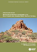
Revised Neoproterozoic stratigraphy in the Mount Conner area, Amadeus Basin, Northern Territory
-
NTGS Record 2018-008
1 file
2018
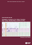
Stratigraphic subdivision of the Velkerri Formation, Roper Group, McArthur Basin, Northern Territory
-
NTGS Record 2018-006
1 file
2018
HyLogger drillhole report for TCDD002, 'Tractor Corner' prospect, Pine Creek Orogen, Northern Territory
-
HDP0067
2 files
2018
Hay River, Northern Territory : GIS data package
-
-
1 file
2018
Summary of results. Joint NTGS-GA geochronology project: Aileron Province, July 2015-June 2016
-
NTGS Record 2018-005
1 file
2018
Summary of results. NTGS LA-ICP-MS geochronology project: Nimbuwah Domain, Pine Creek Orogen, December 2015
-
NTGS Record 2018-004
1 file
2018
NTGS laser ablation ICP-MS in situ zircon petrochronology project: Aileron Province, Jinka and Dneiper 1:100 000 mapsheets
-
NTGS Record 2018-003
1 file
2018
The Use of SkyTEM in the McArthur Basin
-
-
1 file
2018
Tanami Region - Unlocking the Discovery Potential
-
-
1 file
2018
Interpretation-ready Kingdom seismic project - Beetaloo Sub-basin
-
DIP019
3 files
2018
Annual Geoscience Exploration Seminar (AGES) presentations and posters, 20-21 March 2018, Alice Springs, Northern Territory
-
NTGS Record 2018-002
1 file
2018
Annual Geoscience Exploration Seminar (AGES) proceedings, Alice Springs, Northern Territory 20 - 21 March 2018
-
-
1 file
2018
Seismic shift in regional Neoproterozoic correlation, Amadeus Basin, central Australia
-
-
2 files
2018
Exploring for the Future opportunities beneath the Tennant Creek-Mount Isa (TISA) region
-
-
2 files
2018
Positive Traditional Owner engagement - A case study from West Arnhem Land
-
-
2 files
2018
Newmont Tanami Operations: Multiple new discoveries supporting transformational growth in a mature mining camp
-
-
2 files
2018
Discovery of the Lantern deposit, the next chapter for the Pine Creek gold province
-
-
2 files
2018
Orogens to oil: government-industry-academia collaboration to better understand the greater McArthur Basin
-
-
2 files
2018
Protecting Sacred Sites in the Northern Territory
-
-
1 file
2018
Geochemical classification of the Tanami Group - a tool for gold exploration
-
-
2 files
2018
Exploring for the Future - Discovering the South Nicholson Basin region with new seismic data
-
-
2 files
2018
Secrets from the deep: greater McArthur Basin SEEBASE study helps unravel evolution of the basin and its underlying basement
-
-
2 files
2018
Neoproterozoic stratigraphic revisions to key drillholes in the Amadeus Basin - implications for basin palaeogeography and petroleum and minerals potential
-
-
2 files
2018
Integrated precompetitive geoscience transforming understanding of Northern Territory geology
-
-
2 files
2018
Highlights of mineral and petroleum exploration and production in 2017
-
-
2 files
2018
Understanding the architecture of the Batten Fault Zone from the regional to sub-basin scale. Insights from geophysical interpretation and modelling
-
-
2 files
2018
Overview of new geophysical resources in the Northern Territory
-
-
2 files
2018
The Browns polymetallic sulfide deposit, Northern Territory, Australia
-
-
2 files
2018
Geoscience information and delivery in 2017-18
-
-
2 files
2018
Basin-basement contacts as base metal exploration targets: Evidence for mineralising basin brines in central Australia
-
-
2 files
2018
Sedimentology and carbon isotope chemostratigraphy of the Glyde sub-basin, McArthur Basin: Implications for base metals exploration
-
-
2 files
2018
Exploring the southern Amadeus Basin with 2D Seismic
-
-
2 files
2018
Developing new 1:500 000 interpreted geology maps for the Amadeus Basin, Northern Territory: Insights into the structural evolution of the fold-and-thrust belt
-
-
2 files
2018
Investigating controls on mineralisation in the Batten Fault Zone using numerical models
-
-
2 files
2018
The Kyalla Formation prospectivity from a mineralogical and sedimentological perspective
-
-
1 file
2018
Mineralogy variations in the Mamadawerre Sandstone, Kombolgie Subgroup at Angularli Uranium Prospect: Applications to exploration in other areas
-
-
2 files
2018
Northern Cobalt's Wollogorang Cobalt Project, Northern Territory: Geological setting and exploration
-
-
2 files
2018
SEEBASE Study and GIS for greater McArthur Basin
-
DIP017
3 files
2018
SEEBASE Study and GIS for greater McArthur Basin: Supplementary Data
-
DIP018
4 files
Results 1-50 of 58 (Search time: 0.003 seconds).
previous
1
2
next
Discover
Collection
29
AGES abstracts and other papers
3
Digital Information Packages
2
Geophysical and Remote Sensing Data
6
HyLogger Data
2
Maps and Explanatory Notes
16
Reports, Records, Books
Document Type
26
Presentation
25
AGES Abstract
17
NTGS Record
5
HyLogger Data Package
3
GIS Data
3
NTGS Digital Information Package
1
Airborne Magnetic and Radiometric...
1
Conference Proceedings
1
Core Analysis
1
Gravity Survey
.
next >
Geological Province
1
Daly Basin
1
Davenport Province
1
Eromanga Basin
2
Georgina Basin
3
Irindina Province
23
McArthur Basin
1
Money Shoal Basin
1
Musgrave Province
7
Pine Creek Orogen
4
South Nicholson Basin
.
< previous
next >
Map 250
2
Alice Springs SF5314
1
Alligator River SD5301
1
Arnhem Bay SD5303
1
Ayers Rock SG5208
2
Bauhinia Downs SE5303
.
next >
Map 100
1
Adam 6451
1
Areyonga 5349
1
Blue Mud Bay 6070
1
Borroloola 6165
1
Caledon 6272
.
next >