Skip navigation
Home
Browse
Collections
Browse Items by:
Corporate Author
Author
Title Holder/Company
Subject
1:100k mapsheet
1:250k mapsheet
Drillhole
Geological Province
Mine or Prospect
Document Type
Map Scale
Bottom Hole Formation
Survey Name
Stratigraphic Name
Contact Us
Download
Request
Help
Sign on to:
GEMIS
Receive email
updates
Edit Profile
GEMIS
Search
Search:
All Collections
NTGS Products
AGES abstracts and other papers
Digital Information Packages
Geophysical and Remote Sensing Data
HyLogger Data
Maps and Explanatory Notes
Reports, Records, Books
for
Current filters:
Report ID
Document Type
Author
Title
Drillhole
Mine or Prospect
Subject
Title Holder/Company
Abstract
Tenure
Stratigraphy
GIS version
Geological Province
Map250
Map100
Year
Collection
Publisher
Date Added
Equals
Contains
ID
Not Equals
Not Contains
Not ID
Report ID
Document Type
Author
Title
Drillhole
Mine or Prospect
Subject
Title Holder/Company
Abstract
Tenure
Stratigraphy
GIS version
Geological Province
Map250
Map100
Year
Collection
Publisher
Date Added
Equals
Contains
ID
Not Equals
Not Contains
Not ID
Start a new search
Add filters:
Use filters to refine the search results.
Report ID
Document Type
Author
Title
Drillhole
Mine or Prospect
Subject
Title Holder/Company
Abstract
Tenure
Stratigraphy
GIS version
Geological Province
Map250
Map100
Year
Collection
Publisher
Date Added
Equals
Contains
ID
Not Equals
Not Contains
Not ID
Results 1-10 of 30 (Search time: 0.002 seconds).
previous
1
2
3
next
Item hits:
Year
Title
Title Holder/Company
Report id
Preview
Download
2021
Summary of results. Joint NTGS-GA geochronology project: constraining cooling and deformation in the eastern Aileron Province through 40Ar/39Ar step-heating of hornblende, muscovite, and biotite
-
NTGS Record 2021-001
1 file
2021
Summary of results. Laser ablation ICP-MS in situ apatite geochronology of the Molyhil tungsten-molybdenum deposit and Prospect D nickel-copper prospect
-
NTGS Record 2021-007
1 file
2020
Mount Peake, Northern Territory : sheet SF5301
-
-
4 files
2020
HyLogger drillhole report for APDD002, Aileron Province, Northern Territory
-
HDP0084
2 files
2020
NTGS Mount Peake - Crawford: magnetics and radiometrics survey
-
-
5 files
2020
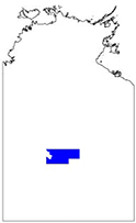
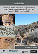
Summary of results. Joint NTGS-GA geochronology project: Aileron and Irindina provinces, Jinka and Dneiper 1:100 000 mapsheets, 2019
-
NTGS Record 2020-001
1 file
2021
Revising the igneous stratigraphy in the eastern Aileron Province: implications for the geodynamic setting between ca 1.81-1.71 Ga
-
-
2 files
2020
New geophysical and remote sensed data in the Northern Territory: 2019
-
-
2 files
2021
Geophysical interpretation of the Tanami Region, northern Aileron and southwest Davenport provinces
-
-
1 file
2021
Annual Geoscience Exploration Seminar (AGES). Presentations and posters
-
NTGS Record 2021-004
1 file
Discover
Collection
12
AGES abstracts and other papers
3
Digital Information Packages
1
Geophysical and Remote Sensing Data
3
HyLogger Data
2
Maps and Explanatory Notes
9
Reports, Records, Books
Geological Province
7
Amadeus Basin
3
Arnhem Province
28
Arunta Region
5
Beetaloo Sub-basin
2
Birrindudu Basin
2
Canning Basin
1
Carpentaria Basin
2
Davenport Province
3
Irindina Province
4
Kalkarindji Province
.
next >
Map 250
1
Alcoota SF5310
1
Alice Springs SF5314
3
Barrow Creek SF5306
1
Hale River SG5303
1
Hermannsburg SF5313
.
next >
Map 100
2
Anningie 5554
1
Chilla 5054
1
Conical Hill 5555
1
Delny 5852
1
Denison 5353
.
next >
Year
14
2021
16
2020