Skip navigation
Home
Browse
Collections
Browse Items by:
Corporate Author
Author
Title Holder/Company
Subject
1:100k mapsheet
1:250k mapsheet
Drillhole
Geological Province
Mine or Prospect
Document Type
Map Scale
Bottom Hole Formation
Survey Name
Stratigraphic Name
Contact Us
Download
Request
Help
Sign on to:
GEMIS
Receive email
updates
Edit Profile
GEMIS
Search
Search:
All Collections
NTGS Products
AGES abstracts and other papers
Digital Information Packages
Geophysical and Remote Sensing Data
HyLogger Data
Maps and Explanatory Notes
Reports, Records, Books
for
Current filters:
Report ID
Document Type
Author
Title
Drillhole
Mine or Prospect
Subject
Title Holder/Company
Abstract
Tenure
Stratigraphy
GIS version
Geological Province
Map250
Map100
Year
Collection
Publisher
Date Added
Equals
Contains
ID
Not Equals
Not Contains
Not ID
Report ID
Document Type
Author
Title
Drillhole
Mine or Prospect
Subject
Title Holder/Company
Abstract
Tenure
Stratigraphy
GIS version
Geological Province
Map250
Map100
Year
Collection
Publisher
Date Added
Equals
Contains
ID
Not Equals
Not Contains
Not ID
Start a new search
Add filters:
Use filters to refine the search results.
Report ID
Document Type
Author
Title
Drillhole
Mine or Prospect
Subject
Title Holder/Company
Abstract
Tenure
Stratigraphy
GIS version
Geological Province
Map250
Map100
Year
Collection
Publisher
Date Added
Equals
Contains
ID
Not Equals
Not Contains
Not ID
Results 1-10 of 26 (Search time: 0.002 seconds).
previous
1
2
3
next
Item hits:
Year
Title
Title Holder/Company
Report id
Preview
Download
2020
NTGS laser ablation ICP-MS U-Pb geochronology project: Habgood and Balma groups (McArthur Basin), Namerinni Group (Tomkinson Province), and unnamed units from drillholes NDW12-01 and Jamison-1, July 2016-May 2019
-
NTGS Record 2020-009
1 file
2021
Kalkarindji through the geophysical lens: structural characteristics of the Kalkarindji basalt from non-seismic geophysical data
-
-
2 files
2021
The Exploring for the Future 2019 Barkly 2D Deep Crustal Reflection Seismic Survey: key discoveries and implication for resources
-
-
2 files
2021
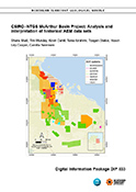
CSIRO-NTGS McArthur Basin Project: analysis and interpretation of historical AEM data sets
-
DIP033
3 files
2020
We get rocked down but we get up again: learnings from Kyalla 117 N2-1
-
-
1 file
2020
New geophysical and remote sensed data in the Northern Territory: 2019
-
-
2 files
2021
Petroleum geology and geochemistry of the Birrindudu Basin, greater McArthur Basin
-
-
2 files
2020
South West McArthur, Barkly Gravity Survey P201901, NT, 2019
-
-
2021
Annual Geoscience Exploration Seminar (AGES). Presentations and posters
-
NTGS Record 2021-004
1 file
2020
Annual Geoscience Exploration Seminar (AGES) presentations and posters, 24 - 20 March 2020, Alice Springs, Northern Territory
-
NTGS Record 2020-003
1 file
Discover
Collection
18
AGES abstracts and other papers
1
Digital Information Packages
1
Geophysical and Remote Sensing Data
3
HyLogger Data
3
Reports, Records, Books
Document Type
13
AGES Abstract
11
Presentation
5
NTGS Record
3
HyLogger Data Package
2
Conference Proceedings
1
Gravity Survey
1
NTGS Digital Information Package
Geological Province
7
Aileron Province
7
Amadeus Basin
3
Arnhem Province
8
Arunta Region
15
Beetaloo Sub-basin
2
Birrindudu Basin
1
Carpentaria Basin
3
Georgina Basin
1
Irindina Province
2
Kalkarindji Province
.
next >
Map 250
1
Arnhem Bay SD5303
1
Auvergne SD5215
2
Bauhinia Downs SE5303
1
Beetaloo SE5306
2
Blue Mud Bay SD5307
.
next >
Map 100
1
Arnhem 6173
1
Blue Mud Bay 6070
1
Daly Waters 5565
1
Gorrie 5567
1
Kilgour 6063
.
next >
Year
10
2021
16
2020