Skip navigation
Home
Browse
Collections
Browse Items by:
Corporate Author
Author
Title Holder/Company
Subject
1:100k mapsheet
1:250k mapsheet
Drillhole
Geological Province
Mine or Prospect
Document Type
Map Scale
Bottom Hole Formation
Survey Name
Stratigraphic Name
Contact Us
Download
Request
Help
Sign on to:
GEMIS
Receive email
updates
Edit Profile
GEMIS
Search
Search:
All Collections
NTGS Products
AGES abstracts and other papers
Digital Information Packages
Geophysical and Remote Sensing Data
HyLogger Data
Maps and Explanatory Notes
Reports, Records, Books
for
Current filters:
Report ID
Document Type
Author
Title
Drillhole
Mine or Prospect
Subject
Title Holder/Company
Abstract
Tenure
Stratigraphy
GIS version
Geological Province
Map250
Map100
Year
Collection
Publisher
Date Added
Equals
Contains
ID
Not Equals
Not Contains
Not ID
Report ID
Document Type
Author
Title
Drillhole
Mine or Prospect
Subject
Title Holder/Company
Abstract
Tenure
Stratigraphy
GIS version
Geological Province
Map250
Map100
Year
Collection
Publisher
Date Added
Equals
Contains
ID
Not Equals
Not Contains
Not ID
Start a new search
Add filters:
Use filters to refine the search results.
Report ID
Document Type
Author
Title
Drillhole
Mine or Prospect
Subject
Title Holder/Company
Abstract
Tenure
Stratigraphy
GIS version
Geological Province
Map250
Map100
Year
Collection
Publisher
Date Added
Equals
Contains
ID
Not Equals
Not Contains
Not ID
Results 1-10 of 80 (Search time: 0.002 seconds).
previous
1
2
3
4
...
8
next
Item hits:
Year
Title
Title Holder/Company
Report id
Preview
Download
2020
NT-wide geophysical stitch: Radiometric, Gridded data
-
-
5 files
2020
HyLogger drillhole report for APDD002, Aileron Province, Northern Territory
-
HDP0084
2 files
2020
NTGS Mount Peake - Crawford: magnetics and radiometrics survey
-
-
5 files
2020
Mount Peake, Northern Territory : sheet SF5301
-
-
4 files
2020
AusAEM 02 WA/NT, 2019-20 Airborne Electromagnetic Survey: TEMPEST(R) airborne electromagnetic data and conductivity estimates
-
-
2020
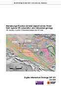
Warramunga Province mineral deposit series: Rover field regional 3D compilation and interpreted geology
-
DIP023
3 files
2020
Exploring for high-grade gold mineralisation: learnings from the Callie deposit
-
-
1 file
2020
HyLogger drillhole report for 19NBDD002, Nabarlek Project, Nimbuwah Domain, Pine Creek Orogen, Northern Territory
-
HDP0087
2 files
2020
Geology and evolution of the Dukas structure, Amadeus Basin, Northern Territory
-
-
1 file
2020
HyLogger drillhole report for WWD001, West Warrego, Warramunga Province, Northern Territory
-
HDP0083
2 files
Discover
Collection
29
AGES abstracts and other papers
6
Digital Information Packages
7
Geophysical and Remote Sensing Data
24
HyLogger Data
3
Maps and Explanatory Notes
11
Reports, Records, Books
Document Type
27
AGES Abstract
24
HyLogger Data Package
12
NTGS Record
9
Presentation
7
GIS Data
6
Airborne Magnetic and Radiometric...
6
NTGS Digital Information Package
3
Gravity Survey
2
Geophysical Image
2
Territory-wide Map
.
next >
Geological Province
16
Aileron Province
10
Amadeus Basin
2
Arnhem Province
17
Arunta Region
7
Beetaloo Sub-basin
1
Birrindudu Basin
1
Canning Basin
2
Carpentaria Basin
3
Daly Basin
1
Eromanga Basin
.
next >
Map 250
1
Alice Springs SF5314
4
Alligator River SD5301
1
Alroy SE5315
1
Arnhem Bay SD5303
1
Avon Downs SF5304
.
next >
Map 100
2
Anningie 5554
1
Arapunga 6053
1
Arnhem 6173
3
Billiatt 5558
1
Blue Mud Bay 6070
.
next >