Skip navigation
Home
Browse
Collections
Browse Items by:
Corporate Author
Author
Title Holder/Company
Subject
1:100k mapsheet
1:250k mapsheet
Drillhole
Geological Province
Mine or Prospect
Document Type
Map Scale
Bottom Hole Formation
Survey Name
Stratigraphic Name
Contact Us
Download
Request
Help
Sign on to:
GEMIS
Receive email
updates
Edit Profile
GEMIS
Search
Search:
All Collections
NTGS Products
AGES abstracts and other papers
Digital Information Packages
Geophysical and Remote Sensing Data
HyLogger Data
Maps and Explanatory Notes
Reports, Records, Books
for
Current filters:
Report ID
Document Type
Author
Title
Drillhole
Mine or Prospect
Subject
Title Holder/Company
Abstract
Tenure
Stratigraphy
GIS version
Geological Province
Map250
Map100
Year
Collection
Publisher
Date Added
Equals
Contains
ID
Not Equals
Not Contains
Not ID
Report ID
Document Type
Author
Title
Drillhole
Mine or Prospect
Subject
Title Holder/Company
Abstract
Tenure
Stratigraphy
GIS version
Geological Province
Map250
Map100
Year
Collection
Publisher
Date Added
Equals
Contains
ID
Not Equals
Not Contains
Not ID
Start a new search
Add filters:
Use filters to refine the search results.
Report ID
Document Type
Author
Title
Drillhole
Mine or Prospect
Subject
Title Holder/Company
Abstract
Tenure
Stratigraphy
GIS version
Geological Province
Map250
Map100
Year
Collection
Publisher
Date Added
Equals
Contains
ID
Not Equals
Not Contains
Not ID
Results 1-10 of 24 (Search time: 0.001 seconds).
previous
1
2
3
next
Item hits:
Year
Title
Title Holder/Company
Report id
Preview
Download
2010
Litchfield North special: interpreted geology, Northern Territory
-
-
2 files
2014
Limbunya, Northern Territory : sheet SE5207
-
-
3 files
2013
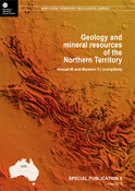
Geology and mineral resources of the Northern Territory: Birrindudu Basin
-
-
1 file
2011
Birrindudu , Northern Territory : sheet SE5211
-
-
3 files
2016
HyLogger drillhole report for 877554_DD90VRB1 'Pear Tree 1', Birrindudu Basin, Northern Territory (Second Edition)
-
HDP0001
2 files
2014
HyLogger drillhole report for MSFDD001, 'Mt Sanford' Birrindudu Basin, Northern Territory
-
HDP0029
2 files
2010
Litchfield South special: interpreted geology, Northern Territory
-
-
2 files
2018
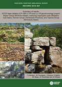
Summary of results. NTGS laser ablation ICP-MS U-Pb and Lu-Hf geochronology project: Roper Group (McArthur Basin), overlying ungrouped units (Beetaloo Sub-basin), Renner Group (Tomkinson Province), and Tijunna Group (Birrindudu Basin)
-
NTGS Record 2018-007
1 file
2016
HyLogger drillhole report for 879511_DD90VRB2 'Pear Tree 2', Birrindudu Basin, Northern Territory (Second Edition)
-
HDP0002
2 files
2019
Detrital zircon geochronology investigations of the Glyde and Favenc packages: Implications for the geological framework of the greater McArthur Basin, Northern Territory
-
-
2 files
Discover
Collection
3
AGES abstracts and other papers
6
HyLogger Data
9
Maps and Explanatory Notes
6
Reports, Records, Books
Document Type
9
250k Geological Map
9
GIS Data
5
HyLogger Data Package
3
AGES Abstract
3
NTGS Record
2
Book Chapter
2
Interpreted Geology Map
1
Book
1
NTGS Report
1
Presentation
.
next >
Geological Province
1
Aileron Province
2
Amadeus Basin
2
Arafura Basin
1
Arnhem Province
1
Arunta Region
1
Beetaloo Sub-basin
4
Bonaparte Basin
2
Canning Basin
4
Carpentaria Basin
5
Daly Basin
.
next >
Map 250
1
Arnhem Bay SD5303
2
Auvergne SD5215
1
Bauhinia Downs SE5303
1
Beetaloo SE5306
1
Birrindudu SE5211
.
next >
Map 100
1
Anson 4971
1
Auvergne 4966
1
Baines 4965
1
Barwolla 5068
1
Birrindudu 4761
.
next >
Year
1
2019
1
2018
1
2017
4
2016
6
2015
4
2014
3
2013
1
2011
3
2010