Skip navigation
Home
Browse
Collections
Browse Items by:
Corporate Author
Author
Title Holder/Company
Subject
1:100k mapsheet
1:250k mapsheet
Drillhole
Geological Province
Mine or Prospect
Document Type
Map Scale
Bottom Hole Formation
Survey Name
Stratigraphic Name
Contact Us
Download
Request
Help
Sign on to:
GEMIS
Receive email
updates
Edit Profile
GEMIS
Search
Search:
All Collections
NTGS Products
AGES abstracts and other papers
Digital Information Packages
Geophysical and Remote Sensing Data
HyLogger Data
Maps and Explanatory Notes
Reports, Records, Books
for
Current filters:
Report ID
Document Type
Author
Title
Drillhole
Mine or Prospect
Subject
Title Holder/Company
Abstract
Tenure
Stratigraphy
GIS version
Geological Province
Map250
Map100
Year
Collection
Publisher
Date Added
Equals
Contains
ID
Not Equals
Not Contains
Not ID
Report ID
Document Type
Author
Title
Drillhole
Mine or Prospect
Subject
Title Holder/Company
Abstract
Tenure
Stratigraphy
GIS version
Geological Province
Map250
Map100
Year
Collection
Publisher
Date Added
Equals
Contains
ID
Not Equals
Not Contains
Not ID
Start a new search
Add filters:
Use filters to refine the search results.
Report ID
Document Type
Author
Title
Drillhole
Mine or Prospect
Subject
Title Holder/Company
Abstract
Tenure
Stratigraphy
GIS version
Geological Province
Map250
Map100
Year
Collection
Publisher
Date Added
Equals
Contains
ID
Not Equals
Not Contains
Not ID
Results 1-50 of 60 (Search time: 0.002 seconds).
previous
1
2
next
Item hits:
Year
Title
Title Holder/Company
Report id
Preview
Download
2001
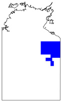
Pargee, Northern Territory : sheet 4758
-
-
1 file
2001
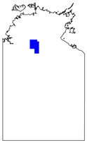
Tanami, Northern Territory : interpreted geology
-
-
1 file
2001
Waterloo : magnetics and radiometrics survey
-
-
2 files
2001
Eromanga : magnetics and radiometrics survey
-
-
4 files
2001
Barkly : magnetics and radiometrics survey
-
-
3 files
2001
Sturt : magnetics and radiometrics survey
-
-
2 files
2001
Tennant Creek bedrock interpretation
-
-
2001
REE and carbonatites in the Eastern Arunta Inlier
-
-
2001
Tectonostratigraphy of the McArthur Basin
-
-
2 files
2001
Information services and delivery
-
-
2001
Landsat 7 : NT Scene 102/76 (14/07/99)
-
-
1 file
2001
Landsat 7 : NT Scene Imagery
-
-
1 file
2001
Native Title and the Grant of Mining & Petroleum Tenure
-
-
2001
Gold mineralisation of the Tanami Region
-
-
2001
Landsat 7 : NT Scene 107/72 (04/08/00)
-
-
1 file
2001
Some aspects of regional correlation and mineralisation
-
-
2001
Landsat 7 : Wave Hill, sheet SE52-08 (11/08/99; 20/08/99)
-
-
1 file
2001
Some tectonothermal surprises in the Eastern Arunta Province
-
-
2001
Landsat 7 : NT Scene 105/76 (20/08/99)
-
-
1 file
2001
Landsat 7 : NT Scene 103/77 (21/06/00)
-
-
1 file
2001
Geochemical datasets from open file company data
-
-
2001
Gold mineralisation of the Tanami region
-
NTGS Record 2001-011
1 file
2001
Structural geology of the Tanami Region
-
NTGS Record 2001-004
1 file
2001
Geophysics in NTGS - Where are we at, and where to next?
-
-
2001
Landsat 7 : NT Scene 103/72 (26/06/00)
-
-
1 file
2001
Landsat 7 : NT Scene 104/71 (11/03/01)
-
-
1 file
2001
Geology and mineralisation of the Tanami Gold Region
-
-
2001
New perspectives of the evolution of the Amadeus Basin
-
-
2001
Landsat 7 : NT Scene 104/76 (29/08/99)
-
-
1 file
2001
Landsat 7 : NT Scene 106/69 (11/08/99)
-
-
1 file
2001
Manganese, bauxite and iron ore deposits of the Northern Territory
-
-
2001
Landsat 7 : NT Scene 102/72 (29/05/00)
-
-
1 file
2001
Landsat 7 : Limbunya, sheet SE52-07 (11/08/99; 20/08/99)
-
-
1 file
2001
Landsat 7 : NT Scene 103/71 (22/08/99)
-
-
1 file
2001
Stream sediment survey of Western MacDonnell Ranges
-
-
2001
Northern Territory airborne geophysical survey specifications
-
NTGS Record 2001-009
1 file
2001
Rum Jungle Region and the Pine Creek Orogen: Synthesis and evaluation of existing data
-
-
2001
The SW Arunta - a terrain area getting younger by the minute
-
-
2001
Landsat 7 : NT Scene 101/72 (05/05/00)
-
-
1 file
2001
The Geology of the McArthur Basin in the Mount Evelyn 1:250 000 sheet area, Northern Territory.
-
NTGS Record 2001-010
1 file
2001
Exploration in a Middle Cambrian carbonate succession, Georgina Basin, Australia
-
-
2001
Landsat 7 : Mt Drummond, sheet SE53-12 (16/07/99; 06/05/00)
-
-
1 file
2001
Igneous rocks of the Tanami Region
-
NTGS Record 2001-003
1 file
2001
Towards an Arunta framework
-
-
2001
Summary of results. Joint NTGS - AGSO Age Determination Program 1999-2001
-
NTGS Record 2001-007
1 file
2001
Landsat 7 : NT Scene 105/74 (20/08/99)
-
-
1 file
2001
Landsat 7 : Waterloo, sheet SE52-03 (11/08/99; 20/08/99)
-
-
1 file
2001
Stream sediment survey of Western MacDonnell Ranges : statistical and GIS-based interpretation
-
DIP002
2 files
2001
Short Range, Northern Territory : explanatory notes
-
-
1 file
2001
Short Range, Northern Territory : sheet 5659
-
-
3 files
Results 1-50 of 60 (Search time: 0.002 seconds).
previous
1
2
next
Discover
Collection
18
AGES abstracts and other papers
1
Digital Information Packages
22
Geophysical and Remote Sensing Data
10
Maps and Explanatory Notes
9
Reports, Records, Books
Document Type
17
AGES Abstract
17
Remote Sensed Data
7
NTGS Record
5
100k Geological Map
5
GIS Data
4
Airborne Magnetic and Radiometric...
4
Explanatory Note
3
NTGS Report
2
250k Geological Map
1
Gravity Survey
.
next >
Geological Province
2
Aileron Province
8
Amadeus Basin
10
Arunta Region
7
Birrindudu Basin
1
Bonaparte Basin
7
Carpentaria Basin
1
Davenport Province
1
Eromanga Basin
8
Georgina Basin
2
Irindina Province
.
next >
Map 250
1
Alcoota SF5310
1
Alice Springs SF5314
2
Alroy SE5315
1
Auvergne SD5215
1
Avon Downs SF5304
.
next >
Map 100
1
Adam 6451
1
Alice Springs 5650
1
Alroy 6159
1
Anburla 5551
1
Austral 6456
.
next >