Skip navigation
Home
Browse
Collections
Browse Items by:
Corporate Author
Author
Title Holder/Company
Subject
1:100k mapsheet
1:250k mapsheet
Drillhole
Geological Province
Mine or Prospect
Document Type
Map Scale
Bottom Hole Formation
Survey Name
Stratigraphic Name
Contact Us
Download
Request
Help
Sign on to:
GEMIS
Receive email
updates
Edit Profile
GEMIS
Search
Search:
All Collections
NTGS Products
AGES abstracts and other papers
Digital Information Packages
Geophysical and Remote Sensing Data
HyLogger Data
Maps and Explanatory Notes
Reports, Records, Books
for
Current filters:
Report ID
Document Type
Author
Title
Drillhole
Mine or Prospect
Subject
Title Holder/Company
Abstract
Tenure
Stratigraphy
GIS version
Geological Province
Map250
Map100
Year
Collection
Publisher
Date Added
Equals
Contains
ID
Not Equals
Not Contains
Not ID
Start a new search
Add filters:
Use filters to refine the search results.
Report ID
Document Type
Author
Title
Drillhole
Mine or Prospect
Subject
Title Holder/Company
Abstract
Tenure
Stratigraphy
GIS version
Geological Province
Map250
Map100
Year
Collection
Publisher
Date Added
Equals
Contains
ID
Not Equals
Not Contains
Not ID
Results 1-50 of 99 (Search time: 0.003 seconds).
previous
1
2
next
Item hits:
Year
Title
Title Holder/Company
Report id
Preview
Download
1999
Landsat 7 : NT Scene 104/68-104/69- 105/69 mosaic
-
-
1996
Robinson River : magnetics and radiometrics survey
-
-
2 files
1990
Rodinga : magnetics and radiometrics survey
-
-
1 file
1995
Mount Peake : magnetics and radiometrics survey
-
-
2 files
1993
Helen Springs : magnetics and radiometrics survey
-
-
2 files
1995
Limbunya : magnetics and radiometrics survey
-
-
2 files
1991
BHP sampling of NTGS Elkedra holes
-
GS1991-010
1 file
1990
Geology of the Northwest section of the Kulgera 1:250,000 sheet - Angas, Western Ebenezer, and northwestern Sentinel Bore 1:100,000 sheets
-
GS1990-001
1 file
1996
Helen Springs stratigraphic drilling 1996 : Nilly Waterhole
-
GS1996-004
1 file
1990
Cu-Pb-Zn-Ag mineralisation within the Pine Creek 1:100 000 sheet
-
GS1990-016
1 file
1999
Bonney Well : magnetics and radiometrics survey
-
-
5 files
1997
Napperby/Hermannsburg : magnetics and radiometrics survey
-
-
4 files
1994
Urapunga : magnetics and radiometrics survey
-
-
3 files
1999
Rum Jungle : magnetics and radiometrics survey
-
-
4 files
1997
Birrindudu : magnetics and radiometrics survey
-
-
4 files
1999
Amadeus West : magnetics and radiometrics survey
-
-
4 files
1998
Mackay : magnetics and radiometrics survey
-
-
4 files
1999
Elkedra : magnetics and radiometrics survey
-
-
4 files
1998
Victoria River Downs : magnetics and radiometrics survey
-
-
5 files
1997
Alcoota/Alice Springs : magnetics and radiometrics survey
-
-
4 files
1993
Mount Theo/Highland Rocks : magnetics and radiometrics survey
-
-
1 file
1992
Milingimbi : magnetics and radiometrics survey
-
-
2 files
1990
Mitchell Ranges : magnetics and radiometrics survey
-
-
2 files
1991
Gove : magnetics and radiometrics survey
-
-
1 file
1993
Groote Eylandt : magnetics and radiometrics survey
-
-
1 file
1994
Port Keats : magnetics and radiometrics survey
-
-
1 file
1998
Tennant Creek : magnetics and radiometrics survey
-
-
1 file
1993
Roper River : magnetics and radiometrics survey
-
-
2 files
1999
South Lake Woods : magnetics and radiometrics survey
-
-
2 files
1992
Jinduckin : magnetics and radiometrics survey
-
-
1 file
1990
Petroleum Basin Studies: Bonaparte Basin
-
GS1990-010
1 file
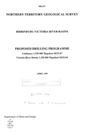
1999
Birrindudu -Victoria River Basins proposed drilling programme
-
NTGS Record 1999-006
1 file
1999
Landsat 7 : NT Scene 100/73 (16/07/99)
-
-
1 file
1994
Petroleum Basin Studies: Amadeus Basin update
-
GS1994-011
1 file
1990
Petroleum Basin Studies: Eromanga Basin
-
GS1990-008
2 files
1994
Petroleum Basin Studies: Georgina Basin
-
GS1994-010
1 file
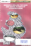
1999
Resource drilling for sand and gravel in parts of Litchfield Shire
-
NTGS Record 1999-009
1 file
1999
Landsat 7 : NT Scene 105/69-106/69 mosaic
-
-
1 file
1999
Landsat 7 : NT Scene 101/76-102/76 mosaic
-
-
1 file
1998
Stuart Highway CH 34 to 122 km, strategic pavement materials resource evaluation
-
NTGS Record 1999-005
1 file
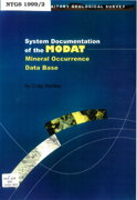
1999
Northern Territory mineral occurrence database (MODAT) : system documentation. Version 1.0
-
NTGS Record 1999-002
1 file
1999
Landsat 7 : NT Scene 104/73 (29/08/99)
-
-
1 file
1990
Petroleum Basin Studies: Eastern Amadeus Basin
-
GS1990-009
1 file
1999
Proposed sand-clay fill extractive site: Jessie Gap, Ross Highway, Alice Springs.
-
NTGS Record 1999-004
1 file
1999
Summary of field observations in the Huckitta region, NE Arunta Inlier, July - August 1998.
-
NTGS Record 1999-001
1 file
1999
Landsat 7 : NT Scene 104/69-105/69 mosaic
-
-
1 file
1993
Limbla, Northern Territory : sheet 5950
-
-
1 file
1991
Bauhinia Downs, Northern Territory : explanatory notes
-
-
1 file
1997
Milingimbi, Northern Territory : sheet SD5302
-
-
4 files
1995
A guide to the geology and landforms of central Australia
-
-
1 file
Results 1-50 of 99 (Search time: 0.003 seconds).
previous
1
2
next
Discover
Collection
32
Geophysical and Remote Sensing Data
45
Maps and Explanatory Notes
22
Reports, Records, Books
Document Type
1
Gravity Survey
1
Interpreted Geology Map
.
< previous
Geological Province
4
Aileron Province
12
Amadeus Basin
10
Arafura Basin
1
Arnhem Province
16
Arunta Region
7
Birrindudu Basin
1
Bonaparte Basin
14
Carpentaria Basin
12
Daly Basin
1
Davenport Province
.
next >
Map 250
2
Alcoota SF5310
2
Alice Springs SF5314
2
Alligator River SD5301
6
Arnhem Bay SD5303
2
Auvergne SD5215
.
next >
Map 100
1
Aileron 5552
1
Alcoota 5752
1
Algamba 6253
1
Alice Springs 5650
1
Alkea 6353
.
next >
Year
26
1999
7
1998
10
1997
3
1996
11
1995
7
1994
12
1993
3
1992
9
1991
11
1990
.
next >