Skip navigation
Home
Browse
Collections
Browse Items by:
Corporate Author
Author
Title Holder/Company
Subject
1:100k mapsheet
1:250k mapsheet
Drillhole
Geological Province
Mine or Prospect
Document Type
Map Scale
Bottom Hole Formation
Survey Name
Stratigraphic Name
Contact Us
Download
Request
Help
Sign on to:
GEMIS
Receive email
updates
Edit Profile
GEMIS
Search
Search:
All Collections
NTGS Products
AGES abstracts and other papers
Digital Information Packages
Geophysical and Remote Sensing Data
HyLogger Data
Maps and Explanatory Notes
Reports, Records, Books
for
Current filters:
Report ID
Document Type
Author
Title
Drillhole
Mine or Prospect
Subject
Title Holder/Company
Abstract
Tenure
Stratigraphy
GIS version
Geological Province
Map250
Map100
Year
Collection
Publisher
Date Added
Equals
Contains
ID
Not Equals
Not Contains
Not ID
Start a new search
Add filters:
Use filters to refine the search results.
Report ID
Document Type
Author
Title
Drillhole
Mine or Prospect
Subject
Title Holder/Company
Abstract
Tenure
Stratigraphy
GIS version
Geological Province
Map250
Map100
Year
Collection
Publisher
Date Added
Equals
Contains
ID
Not Equals
Not Contains
Not ID
Results 11-20 of 524 (Search time: 0.001 seconds).
previous
1
2
3
4
5
...
53
next
Item hits:
Year
Title
Title Holder/Company
Report id
Preview
Download
2014
Protecting sacred sites in the Northern Territory: challenges, current practice and meeting the needs of stakeholders
-
-
2018
Summary of results. NTGS LA-ICP-MS geochronology project: Jervois mineral field, Bonya Hills and Jinka Plain in HUCKITTA, Aileron Province, May 2014-December 2015
-
NTGS Record 2018-012
1 file
2018
Orogens to oil: government-industry-academia collaboration to better understand the greater McArthur Basin
-
-
2 files
2018
Protecting Sacred Sites in the Northern Territory
-
-
1 file
2019
New geophysical and remote sensed data in the Northern Territory
-
-
2 files
2017
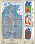
Relief map of the Northern Territory
-
-
1 file
2015
HyLogger drillhole report for Bullo River 1, Birrindudu Basin, Northern Territory
-
HDP0040
2 files
2019
Integration of reprocessing, depth imaging and interpretation in legacy data to provide new insights into salt tectonics and sub salt imaging in the Amadeus Basin, NT
-
-
2 files
2017
HyLogger drillhole report for WRDD0134, 'Wellington Range' Nimbuwah Domain, Pine Creek Orogen, Northern Territory
-
HDP0061
2 files
2015
Unlocking potential for unconventional petroleum resources in the frontier McArthur Basin, Northern Territory
-
-
Discover
Collection
255
AGES abstracts and other papers
9
Digital Information Packages
16
Geophysical and Remote Sensing Data
96
HyLogger Data
28
Maps and Explanatory Notes
120
Reports, Records, Books
Document Type
232
AGES Abstract
98
NTGS Record
83
Presentation
79
HyLogger Data Package
42
Book Chapter
28
GIS Data
16
250k Geological Map
10
Gravity Survey
9
NTGS Digital Information Package
7
NTGS Technical Note
.
next >
Geological Province
45
Aileron Province
68
Amadeus Basin
4
Arafura Basin
19
Arnhem Province
72
Arunta Region
14
Beetaloo Sub-basin
24
Birrindudu Basin
7
Bonaparte Basin
1
Browse Basin
4
Canning Basin
.
next >
Map 250
9
Alice Springs SF5314
5
Alligator River SD5301
4
Alroy SE5315
3
Arnhem Bay SD5303
2
Auvergne SD5215
.
next >
Map 100
1
Adam 6451
3
Alroy 6159
1
Anson 4971
1
Arapunga 6053
2
Areyonga 5349
.
next >
Year
56
2019
58
2018
50
2017
47
2016
70
2015
65
2014
74
2013
35
2012
31
2011
38
2010
.
next >