Skip navigation
Home
Browse
Collections
Browse Items by:
Corporate Author
Author
Title Holder/Company
Subject
1:100k mapsheet
1:250k mapsheet
Drillhole
Geological Province
Mine or Prospect
Document Type
Map Scale
Bottom Hole Formation
Survey Name
Stratigraphic Name
Contact Us
Download
Request
Help
Sign on to:
GEMIS
Receive email
updates
Edit Profile
GEMIS
Search
Search:
All Collections
NTGS Products
AGES abstracts and other papers
Digital Information Packages
Geophysical and Remote Sensing Data
HyLogger Data
Maps and Explanatory Notes
Reports, Records, Books
for
Current filters:
Report ID
Document Type
Author
Title
Drillhole
Mine or Prospect
Subject
Title Holder/Company
Abstract
Tenure
Stratigraphy
GIS version
Geological Province
Map250
Map100
Year
Collection
Publisher
Date Added
Equals
Contains
ID
Not Equals
Not Contains
Not ID
Start a new search
Add filters:
Use filters to refine the search results.
Report ID
Document Type
Author
Title
Drillhole
Mine or Prospect
Subject
Title Holder/Company
Abstract
Tenure
Stratigraphy
GIS version
Geological Province
Map250
Map100
Year
Collection
Publisher
Date Added
Equals
Contains
ID
Not Equals
Not Contains
Not ID
Results 1-50 of 112 (Search time: 0.002 seconds).
previous
1
2
3
next
Item hits:
Year
Title
Title Holder/Company
Report id
Preview
Download
2025
Huckitta, Northern Territory : sheet SF5311
-
-
6 files
2023
Compilation of 1:250 000 geology map series GIS
-
DIP041
2 files
2023
Henbury, Northern Territory : sheet SG5301
-
-
4 files
2020
Mount Peake, Northern Territory : sheet SF5301
-
-
4 files
1978
South Lake Woods, Northern Territory : sheet SE5309
-
-
4 files
1964
Tanumbirini, Northern Territory : sheet SE5302
-
-
4 files
2000
The Granites : interpreted geology, Northern Territory : sheet SF5203
-
-
2 files
1963
Pellew, Northern Territory : sheet SD5316
-
-
4 files
2004
Mount Liebig : interpreted geology, Northern Territory : sheet SF5216
-
-
2 files
1963
Hodgson Downs, Northern Territory : sheet SD5314
-
-
3 files
2003
Sandover River, Northern Territory : sheet SF5308
-
-
4 files
1997
Milingimbi, Northern Territory : sheet SD5302
-
-
4 files
1978
Winnecke Creek, Northern Territory : sheet SE5212
-
-
3 files
2005
Mount Theo : interpreted geology, Northern Territory : sheet SF5208
-
-
2 files
2014
The Granites, Northern Territory : sheet SF5203
-
-
4 files
1988
Darwin, Northern Territory : sheet SD5204
-
-
4 files
1986
Bonney Well , Northern Territory : sheet SF5302
-
-
3 files
1975
Fog Bay, Northern Territory : sheet SD5203
-
-
3 files
1969
Newcastle Waters, Northern Territory : sheet SE5305
-
-
4 files
1975
Bathurst Island, Northern Territory : sheet SC5215
-
-
3 files
1973
Simpson Desert North, Northern Territory : sheet SG5304
-
-
4 files
2008
Lake Mackay : interpreted geology, Northern Territory : sheet SF5211
-
-
2 files
2005
Avon Downs , Northern Territory : sheet SF5304
-
-
3 files
1991
Bauhinia Downs, Northern Territory : sheet SE5303
-
-
3 files
1983
Alligator River, Northern Territory : sheet SD5301
-
-
3 files
2002
Robinson River, Northern Territory : sheet SE5304
-
-
4 files
2010
Frew River , Northern Territory : sheet SF5303
-
-
3 files
1971
Cape Scott, Northern Territory : sheet SD5207
-
-
3 files
1998
Tennant Creek, Northern Territory : sheet SE5314
-
-
4 files
1995
Groote Eylandt Region , Northern Territory
-
-
3 files
2006
Highland Rocks : interpreted geology, Northern Territory : sheet SF5207
-
-
2 files
1982
Napperby , Northern Territory : sheet SF5309
-
-
3 files
2010
Brunette Downs , Northern Territory : sheet SE5311
-
-
4 files
2000
Tanami : interpreted geology, Northern Territory : sheet SE5215
-
-
2 files
2014
Calvert Hills, Northern Territory : sheet SE5308
-
-
4 files
2006
Mount Drummond, Northern Territory : sheet SE5312
-
-
4 files
2014
Delamere, Northern Territory : sheet SD5216
-
-
3 files
1975
Tanami, Northern Territory : sheet SE5215
-
-
4 files
2003
Tobermorey (formerly Tobermory), Northern Territory : sheet SF5312
-
-
4 files
2003
Mount Liebig, Northern Territory : sheet SF5216
-
-
3 files
1972
Port Keats, Northern Territory : sheet SD5211
-
-
3 files
1963
Hay River , Northern Territory : sheet SF5316
-
-
2 files
1968
Hale River, Northern Territory : sheet SG5303
-
-
3 files
2008
Lake Mackay, Northern Territory : sheet SF5211
-
-
3 files
1967
Avon Downs , Northern Territory : sheet SF5304
-
-
1993
Mount Young, Northern Territory : sheet SD5315
-
-
3 files
1967
Bloods Range , Northern Territory: sheet SG5203
-
-
3 files
1995
Hermannsburg, Northern Territory : sheet SF5313
-
-
3 files
1994
Katherine, Northern Territory : sheet SD5309
-
-
3 files
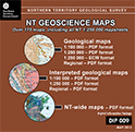
2024
NT Geoscience Maps
-
DIP009
2 files
Results 1-50 of 112 (Search time: 0.002 seconds).
previous
1
2
3
next
Discover
Collection
2
Digital Information Packages
109
Maps and Explanatory Notes
1
Reports, Records, Books
Document Type
102
GIS Data
16
Interpreted Geology Map
2
NTGS Digital Information Package
1
100k Geological Map
1
Explanatory Note
1
NTGS Report
1
Regional Map
1
Territory-wide Map
Geological Province
3
Aileron Province
17
Amadeus Basin
6
Arafura Basin
24
Arunta Region
14
Birrindudu Basin
4
Bonaparte Basin
2
Canning Basin
15
Carpentaria Basin
8
Daly Basin
3
Davenport Province
.
next >
Map 250
1
Alcoota SF5310
1
Alice Springs SF5314
1
Alligator River SD5301
2
Alroy SE5315
2
Arnhem Bay SD5303
.
next >
Map 100
1
Adam 6451
1
Aileron 5552
1
Alcoota 5752
1
Algamba 6253
1
Alice Springs 5650
.
next >
Year
5
2020 - 2029
16
2010 - 2019
31
2000 - 2009
18
1990 - 1999
8
1980 - 1989
15
1970 - 1979
19
1963 - 1969