Skip navigation
Home
Browse
Collections
Browse Items by:
Corporate Author
Author
Title Holder/Company
Subject
1:100k mapsheet
1:250k mapsheet
Drillhole
Geological Province
Mine or Prospect
Document Type
Map Scale
Bottom Hole Formation
Survey Name
Stratigraphic Name
Contact Us
Download
Request
Help
Sign on to:
GEMIS
Receive email
updates
Edit Profile
GEMIS
Search
Search:
All Collections
NTGS Products
AGES abstracts and other papers
Digital Information Packages
Geophysical and Remote Sensing Data
HyLogger Data
Maps and Explanatory Notes
Reports, Records, Books
for
Current filters:
Report ID
Document Type
Author
Title
Drillhole
Mine or Prospect
Subject
Title Holder/Company
Abstract
Tenure
Stratigraphy
GIS version
Geological Province
Map250
Map100
Year
Collection
Publisher
Date Added
Equals
Contains
ID
Not Equals
Not Contains
Not ID
Start a new search
Add filters:
Use filters to refine the search results.
Report ID
Document Type
Author
Title
Drillhole
Mine or Prospect
Subject
Title Holder/Company
Abstract
Tenure
Stratigraphy
GIS version
Geological Province
Map250
Map100
Year
Collection
Publisher
Date Added
Equals
Contains
ID
Not Equals
Not Contains
Not ID
Results 251-300 of 604 (Search time: 0.061 seconds).
previous
1
...
3
4
5
6
7
8
9
...
13
next
Item hits:
Year
Title
Title Holder/Company
Report id
Preview
Download
2016
Summary of results. NTGS laser ablation ICP-MS in situ monazite and xenotime geochronology project: Arunta Region, Jervois Range 1:100 000 map sheet
-
NTGS Record 2016-004
1 file
2016
HyLogger drillhole report for NDW12-01 'Daly Waters', McArthur Basin, Northern Territory
-
HDP0058
2 files
2016
HyLogger drillhole report for MBXDD002, Matchbox Project, McArthur Basin, Northern Territory
-
HDP0057
2 files
2016
Pyrite trace element chemistry of black shales in the McArthur Basin: a recorder for atmospheric oxygenation and exploration tool for Zn-Pb SEDEX style deposits
-
-
1 file
2016
Sedimentary characterisation and correlation of the Wilton package, greater McArthur Basin
-
-
1 file
2016
Geomechanics, stress regime and mineralogy of the Arthur Creek Formation and Thorntonia Limestone, southern Georgina Basin
-
-
1 file
2016
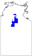
COBRA - The assessment of petroleum and mineral resource potential of the Amadeus Basin
-
-
1 file
2016
Integrated geoscience projects through the CORE initiative
-
-
1 file
2016
Newmarket Gold Inc provides an update on the Maud Creek Gold Project
-
-
1 file
2016
Early indications of a copper-gold belt in the southwestern Aileron Province
-
-
1 file
2016
Annual Geoscience Exploration Seminar (AGES) proceedings, Alice Springs, Northern Territory 15 - 16 March 2016
-
-
1 file
2016
Animals and vegetables for minerals: biogeochemical exploration through sedimentary cover from tropical savannahs to arid shrublands of the Northern Territory
-
-
1 file
2016
Geophysical data in the Northern Territory: insights from government and industry acquired data
-
-
1 file
2016
Exploration of the Teena Zinc Prospect New insights for the discovery of shale-hosted zinc deposits in Northern Australia
-
-
1 file
2016
Overview of mineral and petroleum exploration and production in 2015
-
-
1 file
2016
Exploring the sub-salt play in the frontier Amadeus Basin insights from potential field data analysis
-
-
1 file
2016
Multiply reactivated crustal-scale structures and a long-lived counter-clockwise P T path: New insights into the 1.5 billion year tectonothermal evolution of the eastern Arunta Region, central Australia
-
-
1 file
2016
Roper Basin burial history modelling: inferences for the timing of hydrocarbon generation
-
-
1 file
2016
Exploration success and resource growth at Newmont's Tanami Operations, Northern Territory
-
-
1 file
2016
SEDEX potential of the Tawallah Group, lower McArthur Basin
-
-
1 file
2016
Palaeoproterozoic copper mineralisation in the Aileron Province: new findings on temporal, spatial and genetic features
-
-
1 file
2016
The greater McArthur Basin 3D modelling project: updates, developments and steps towards the future
-
-
1 file
2016
Unconventional gas potential in Proterozoic source rocks: exploring the Beetaloo Sub-basin
-
-
1 file
2016
Analysis and reinterpretation of historical AEM data sets: McArthur Basin, NT
-
-
1 file
2016
Geoscience information updates to online systems, data and products in 2015 16
-
-
1 file
2016
Discovering the undiscovered New ideas and technology in the mature Tennant Creek Mineral Field
-
-
1 file
2016
Petroleum geochemistry of the Amadeus Basin
-
-
1 file
2016
Geophysical exploration and discovery at Jervois
-
-
1 file
2016
From the back of the shed to the forefront of exploration: what the NTGS core store is revealing about the Roper Group shales of the greater McArthur Basin
-
-
1 file
2016
1.4 billion years of Northern Territory geology: insights from collaborative U-Pb zircon and baddeleyite dating
-
-
1 file
2015
Delamere & Spirit Hills : magnetics and radiometrics survey
-
-
4 files
2016
Annual Geoscience Exploration Seminar (AGES) 2016. Presentations
-
NTGS Record 2016-001
1 file
2014
Dunmarra : magnetics and radiometrics survey
-
-
3 files
2016
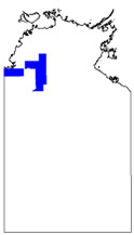
COBRA - Amadeus Basin assessment of resource potential
-
DIP016
2 files
2016
Summary of results. NTGS laser ablation ICP-MS in situ zircon and baddeleyite geochronology project: Mount Peake Gabbro, Arunta Region
-
NTGS Record 2016-002
1 file
2020
NT-wide geophysical stitch: Radiometric, Gridded data
-
-
5 files
2015
Unlocking potential unconventional petroleum resources in the frontier McArthur Basin, Northern Territory
-
-
1 file
2020
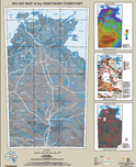
Magnetic map of the Northern Territory
-
-
1 file
2020
Radiometric map of the Northern Territory
-
-
1 file
2020
NT-wide geophysical stitch: Magnetic, Gridded data
-
-
4 files
2014
A systematic appraisal of the Neoproterozoic stratigraphy of the Amadeus Basin, building a framework for assessing resource potential
-
-
2014
Stratigraphic drilling report for the Tanami and The Granites 1:250 000 map areas, Northern Territory
-
NTGS Record 2014-006
1 file
2013
Alligator Rivers uranium: Facts and fiction
-
-
2015
Unlocking potential for unconventional petroleum resources in the frontier McArthur Basin, Northern Territory
-
-
2014
Introducing GEMIS, mineral exploration reports online, and new products
-
-
2014
Santos NT exploration - insights into the geology of the Amadeus and McArthur basins from new seismic data
-
-
2014
Protecting sacred sites in the Northern Territory: challenges, current practice and meeting the needs of stakeholders
-
-
2017
Relief map of the Northern Territory
-
-
1 file
2014
New insights into the expanse of the McArthur Superbasin
-
-
2010
Archaean and Palaeoproterozoic crustal evolution processes in the Pine Creek Orogen: U-Pb, Hf, O, Nd isotopic data and geochemistry
-
-
Results 251-300 of 604 (Search time: 0.061 seconds).
previous
1
...
3
4
5
6
7
8
9
...
13
next
Discover
Collection
284
AGES abstracts and other papers
15
Digital Information Packages
23
Geophysical and Remote Sensing Data
120
HyLogger Data
31
Maps and Explanatory Notes
131
Reports, Records, Books
Document Type
259
AGES Abstract
110
NTGS Record
103
HyLogger Data Package
92
Presentation
42
Book Chapter
35
GIS Data
17
250k Geological Map
15
NTGS Digital Information Package
13
Gravity Survey
10
Airborne Magnetic and Radiometric...
.
next >
Geological Province
61
Aileron Province
78
Amadeus Basin
4
Arafura Basin
21
Arnhem Province
89
Arunta Region
21
Beetaloo Sub-basin
25
Birrindudu Basin
7
Bonaparte Basin
1
Browse Basin
5
Canning Basin
.
next >
Map 250
10
Alice Springs SF5314
9
Alligator River SD5301
5
Alroy SE5315
4
Arnhem Bay SD5303
2
Auvergne SD5215
.
next >
Map 100
1
Adam 6451
3
Alroy 6159
2
Anningie 5554
1
Anson 4971
2
Arapunga 6053
.
next >
Year
56
2019
58
2018
50
2017
47
2016
70
2015
65
2014
74
2013
35
2012
31
2011
38
2010
.
next >