Skip navigation
Home
Browse
Collections
Browse Items by:
Corporate Author
Author
Title Holder/Company
Subject
1:100k mapsheet
1:250k mapsheet
Drillhole
Geological Province
Mine or Prospect
Document Type
Map Scale
Bottom Hole Formation
Survey Name
Stratigraphic Name
Contact Us
Download
Request
Help
Sign on to:
GEMIS
Receive email
updates
Edit Profile
GEMIS
Search
Search:
All Collections
NTGS Products
AGES abstracts and other papers
Digital Information Packages
Geophysical and Remote Sensing Data
HyLogger Data
Maps and Explanatory Notes
Reports, Records, Books
for
Current filters:
Report ID
Document Type
Author
Title
Drillhole
Mine or Prospect
Subject
Title Holder/Company
Abstract
Tenure
Stratigraphy
GIS version
Geological Province
Map250
Map100
Year
Collection
Publisher
Date Added
Equals
Contains
ID
Not Equals
Not Contains
Not ID
Start a new search
Add filters:
Use filters to refine the search results.
Report ID
Document Type
Author
Title
Drillhole
Mine or Prospect
Subject
Title Holder/Company
Abstract
Tenure
Stratigraphy
GIS version
Geological Province
Map250
Map100
Year
Collection
Publisher
Date Added
Equals
Contains
ID
Not Equals
Not Contains
Not ID
Results 301-350 of 409 (Search time: 0.002 seconds).
previous
1
...
4
5
6
7
8
9
next
Item hits:
Year
Title
Title Holder/Company
Report id
Preview
Download
2001
Towards an Arunta framework
-
-
2002
Diamond exploration in the Northern Territory
-
-
2000
Landsat 7 : NT Scene 101/78 (07/06/00)
-
-
1 file
2004
Geology of the Tennant Region
-
-
2 files
2001
Summary of results. Joint NTGS - AGSO Age Determination Program 1999-2001
-
NTGS Record 2001-007
1 file
2004
Geochronology in the Pine Creek Orogen new results from NTGS
-
-
2002
Stratigraphy, structure and mineralisation, Rum Jungle mineral field, Northern Territory
-
NTGS Record 2002-005
1 file
2008
Initial results from Geoscience Australia's Onshore Energy Security Program
-
-
2001
Landsat 7 : NT Scene 105/74 (20/08/99)
-
-
1 file
2004
New advances in the Amadeus Basin
-
-
2000
Landsat 7 : NT Scene 102/75 (26/03/00)
-
-
1 file
2005
The Musgrave Province NT s most underexplored terrane
-
-
2000
Landsat 7 : NT Scene 102/73 (29/05/00)
-
-
1 file
2003
Eastern Pine Creek Orogen - Uranium (+-gold+-PGE)deposits and implications of mineralisation models
-
-
2003
McArthur Basin seismic project - Batten Trough transect
-
-
2000
Seigal 1:100 000 mapsheet GIS dataset
-
NTGS Record 1999-011
1 file
2004
Metallogeny in the eastern Arunta Region and the potential of its Palaeoproterozoic rocks
-
-
2009
Phosphate prospectivity in the Northern Territory
-
-
2000
Directions of the Northern Territory Geological Survey under the Exploration Initiative
-
-
2008
Mount Peake - Lander River, Northern Territory : combined explanatory notes
-
-
1 file
2006
Atlas of regolith materials of the Northern Territory
-
-
1 file
2001
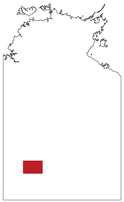
Stream sediment survey of Western MacDonnell Ranges : statistical and GIS-based interpretation
-
DIP002
2 files
2003
Mount Liebig, Northern Territory : sheet SF5216
-
-
3 files
2003
Tobermorey (formerly Tobermory), Northern Territory : sheet SF5312
-
-
4 files
2004
Noonamah, Northern Territory : sheet 5172
-
-
2 files
2005
Tin-tantalum pegmatite mineralisation of the Northern Territory
-
NTGS Report 16
1 file
2003
Annual geoscience exploration seminar (AGES), 2003. Record of abstracts
-
NTGS Record 2003-001
2 files
2005
Mount Liebig, Northern Territory : explanatory notes
-
-
1 file
2000
Wilson Creek, Northern Territory : sheet 4959
-
-
1 file
2002
Robinson River, Northern Territory : sheet SE5304
-
-
4 files
2005
Annual geoscience exploration seminar (AGES), 2005. Record of abstracts
-
NTGS Record 2005-001
1 file
2008
Lake Mackay, Northern Territory : sheet SF5211
-
-
3 files
2001
Helen Springs, Northern Territory : explanatory notes
-
-
1 file
2004
Woodgreen, Northern Territory : sheet 5753
-
-
2 files
2005
Birrindudu : gravity survey
-
-
1 file
2000
The Granites : interpreted geology, Northern Territory : sheet SF5203
-
-
2 files
2001
Short Range, Northern Territory : explanatory notes
-
-
1 file
2007
Woodgreen, Northern Territory : explanatory notes
-
-
1 file
2007
Geology and resource potential of the southern Georgina Basin : GIS package and report
-
DIP007
2 files
2008
Mount Drummond, Northern Territory : explanatory notes
-
-
1 file
2000
Auvergne, Northern Territory : explanatory notes
-
-
1 file
2009
Annual geoscience exploration seminar (AGES), 2009. Record of abstracts
-
NTGS Record 2009-002
1 file
2002
Annual geoscience exploration seminar (AGES), 2002. Record of abstracts
-
NTGS Record 2002-003
2 files
2005
Mount Solitaire, Northern Territory : sheet SF5204
-
-
4 files
2001
Urapunga-Roper River, Northern Territory
-
-
3 files
2003
Tennant Creek : interpreted geology, Northern Territory : sheet SE5314
-
-
2 files
2006
Mount Drummond, Northern Territory : sheet SE5312
-
-
4 files
2000
Tanami : interpreted geology, Northern Territory : sheet SE5215
-
-
2 files
2004
Noonamah, Northern Territory : explanatory notes
-
-
1 file
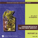
2006
Uranium deposits of the Northern Territory
-
NTGS Report 20
1 file
Results 301-350 of 409 (Search time: 0.002 seconds).
previous
1
...
4
5
6
7
8
9
next
Discover
Collection
185
AGES abstracts and other papers
2
Digital Information Packages
79
Geophysical and Remote Sensing Data
76
Maps and Explanatory Notes
67
Reports, Records, Books
Document Type
175
AGES Abstract
66
NTGS Record
57
Remote Sensed Data
48
GIS Data
31
250k Geological Map
25
Explanatory Note
16
100k Geological Map
16
Airborne Magnetic and Radiometric...
16
Interpreted Geology Map
9
NTGS Report
.
next >
Geological Province
7
Aileron Province
41
Amadeus Basin
2
Arafura Basin
68
Arunta Region
28
Birrindudu Basin
2
Bonaparte Basin
2
Canning Basin
15
Carpentaria Basin
9
Daly Basin
4
Davenport Province
.
next >
Map 250
8
Alcoota SF5310
8
Alice Springs SF5314
8
Alligator River SD5301
9
Alroy SE5315
6
Auvergne SD5215
.
next >
Map 100
1
Adam 6451
1
Aileron 5552
2
Algamba 6253
1
Alice Springs 5650
2
Alkea 6353
.
next >
Year
26
2008
29
2007
31
2006
42
2005
43
2004
32
2003
43
2002
60
2001
81
2000
4
1999
.
next >