Skip navigation
Home
Browse
Collections
Browse Items by:
Corporate Author
Author
Title Holder/Company
Subject
1:100k mapsheet
1:250k mapsheet
Drillhole
Geological Province
Mine or Prospect
Document Type
Map Scale
Bottom Hole Formation
Survey Name
Stratigraphic Name
Contact Us
Download
Request
Help
Sign on to:
GEMIS
Receive email
updates
Edit Profile
GEMIS
Search
Search:
All Collections
NTGS Products
AGES abstracts and other papers
Digital Information Packages
Geophysical and Remote Sensing Data
HyLogger Data
Maps and Explanatory Notes
Reports, Records, Books
for
Current filters:
Report ID
Document Type
Author
Title
Drillhole
Mine or Prospect
Subject
Title Holder/Company
Abstract
Tenure
Stratigraphy
GIS version
Geological Province
Map250
Map100
Year
Collection
Publisher
Date Added
Equals
Contains
ID
Not Equals
Not Contains
Not ID
Report ID
Document Type
Author
Title
Drillhole
Mine or Prospect
Subject
Title Holder/Company
Abstract
Tenure
Stratigraphy
GIS version
Geological Province
Map250
Map100
Year
Collection
Publisher
Date Added
Equals
Contains
ID
Not Equals
Not Contains
Not ID
Start a new search
Add filters:
Use filters to refine the search results.
Report ID
Document Type
Author
Title
Drillhole
Mine or Prospect
Subject
Title Holder/Company
Abstract
Tenure
Stratigraphy
GIS version
Geological Province
Map250
Map100
Year
Collection
Publisher
Date Added
Equals
Contains
ID
Not Equals
Not Contains
Not ID
Results 21-30 of 65 (Search time: 0.005 seconds).
previous
1
2
3
4
5
6
...
7
next
Item hits:
Year
Title
Title Holder/Company
Report id
Preview
Download
2014
Geoscience Australia's onshore hydrocarbons program in Northern Territory basins, with reference to HyLoggingTM in the Georgina Basin
-
-
2014
Old Pirate High-Grade Gold Project: new insights into geology and the use of bulk sampling as an exploration tool
-
-
2014
Preliminary basement architecture of the greater McArthur Basin from gravity inversions
-
-
2014
Correlation between HyLogger data and sedimentology across the McArthur Basin - Phase 1
-
-
2014
Unravelling the McArthur Basin fault architecture and comparisons with the Mount Isa terrane
-
-
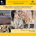
2014
Summary of results. Joint NTGS-GA geochronology project : Amadeus Basin, Arunta Region and Murphy Province, July 2012-June 2013
-
NTGS Record 2014-005
1 file
2014
Building on the geological framework of the eastern Arunta Region: recent regional geological investigations in the Jervois Range area
-
-
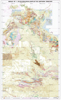
2014
Mosaic of 1:2 500 000 geological maps of the Northern Territory
-
-
1 file
2014
An integrated geological model for Tennant Creek style Au-Bi-Cu mineralisation
-
-
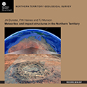
2014
Meteorites and impact structures in the Northern Territory
-
NTGS Record 2014-007
1 file
Discover
Collection
26
AGES abstracts and other papers
2
Geophysical and Remote Sensing Data
26
HyLogger Data
5
Maps and Explanatory Notes
6
Reports, Records, Books
Document Type
25
HyLogger Data Package
24
AGES Abstract
7
NTGS Record
4
250k Geological Map
4
GIS Data
1
Airborne Magnetic and Radiometric...
1
Gravity Survey
1
NTGS Report
1
NTGS Technical Note
1
Presentation
.
next >
Geological Province
9
Amadeus Basin
1
Arafura Basin
2
Arunta Region
4
Birrindudu Basin
1
Bonaparte Basin
2
Canning Basin
3
Carpentaria Basin
2
Daly Basin
1
Dunmarra Basin
1
Eromanga Basin
.
next >
Map 250
1
Alroy SE5315
1
Avon Downs SF5304
1
Ayers Rock SG5208
1
Bauhinia Downs SE5303
1
Beetaloo SE5306
.
next >
Map 100
1
Arapunga 6053
1
Areyonga 5349
1
Argadargada 6254
1
Calvert Hills 6363
1
Coanjula 6262
.
next >