Skip navigation
Home
Browse
Collections
Browse Items by:
Corporate Author
Author
Title Holder/Company
Subject
1:100k mapsheet
1:250k mapsheet
Drillhole
Geological Province
Mine or Prospect
Document Type
Map Scale
Bottom Hole Formation
Survey Name
Stratigraphic Name
Contact Us
Download
Request
Help
Sign on to:
GEMIS
Receive email
updates
Edit Profile
GEMIS
Search
Search:
All Collections
NTGS Products
AGES abstracts and other papers
Digital Information Packages
Geophysical and Remote Sensing Data
HyLogger Data
Maps and Explanatory Notes
Reports, Records, Books
for
Current filters:
Report ID
Document Type
Author
Title
Drillhole
Mine or Prospect
Subject
Title Holder/Company
Abstract
Tenure
Stratigraphy
GIS version
Geological Province
Map250
Map100
Year
Collection
Publisher
Date Added
Equals
Contains
ID
Not Equals
Not Contains
Not ID
Report ID
Document Type
Author
Title
Drillhole
Mine or Prospect
Subject
Title Holder/Company
Abstract
Tenure
Stratigraphy
GIS version
Geological Province
Map250
Map100
Year
Collection
Publisher
Date Added
Equals
Contains
ID
Not Equals
Not Contains
Not ID
Start a new search
Add filters:
Use filters to refine the search results.
Report ID
Document Type
Author
Title
Drillhole
Mine or Prospect
Subject
Title Holder/Company
Abstract
Tenure
Stratigraphy
GIS version
Geological Province
Map250
Map100
Year
Collection
Publisher
Date Added
Equals
Contains
ID
Not Equals
Not Contains
Not ID
Results 1-50 of 109 (Search time: 0.002 seconds).
previous
1
2
3
next
Item hits:
Year
Title
Title Holder/Company
Report id
Preview
Download
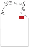
2023
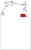
Henbury, Northern Territory : sheet SG5301
-
-
4 files
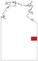
2020
Mount Peake, Northern Territory : sheet SF5301
-
-
4 files
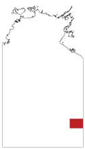
1978
Winnecke Creek, Northern Territory : sheet SE5212
-
-
3 files
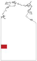
1997
Milingimbi, Northern Territory : sheet SD5302
-
-
4 files
2003
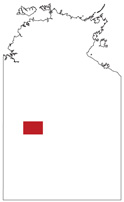
Mount Liebig, Northern Territory : sheet SF5216
-
-
3 files
2003
Tobermorey (formerly Tobermory), Northern Territory : sheet SF5312
-
-
4 files
2010
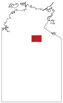
Frew River , Northern Territory : sheet SF5303
-
-
3 files
1971
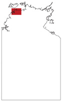
Cape Scott, Northern Territory : sheet SD5207
-
-
3 files
2002
Robinson River, Northern Territory : sheet SE5304
-
-
4 files
1991
Bauhinia Downs, Northern Territory : sheet SE5303
-
-
3 files
1967
Avon Downs , Northern Territory : sheet SF5304
-
-
1963
Hay River , Northern Territory : sheet SF5316
-
-
2 files
2008
Lake Mackay, Northern Territory : sheet SF5211
-
-
3 files
1993
Mount Young, Northern Territory : sheet SD5315
-
-
3 files
1968
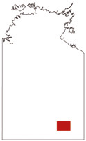
Hale River, Northern Territory : sheet SG5303
-
-
3 files
1983
Alligator River, Northern Territory : sheet SD5301
-
-
3 files
1964
Tanumbirini, Northern Territory : sheet SE5302
-
-
4 files
1978
South Lake Woods, Northern Territory : sheet SE5309
-
-
4 files
1975
Fog Bay, Northern Territory : sheet SD5203
-
-
3 files
1975
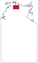
Bathurst Island, Northern Territory : sheet SC5215
-
-
3 files
2000
The Granites : interpreted geology, Northern Territory : sheet SF5203
-
-
2 files
1986
Bonney Well , Northern Territory : sheet SF5302
-
-
3 files
1969
Newcastle Waters, Northern Territory : sheet SE5305
-
-
4 files
1988
Darwin, Northern Territory : sheet SD5204
-
-
4 files
1963
Hodgson Downs, Northern Territory : sheet SD5314
-
-
3 files
2005
Mount Solitaire, Northern Territory : sheet SF5204
-
-
4 files
2001
Urapunga-Roper River, Northern Territory
-
-
3 files
2003
Tennant Creek : interpreted geology, Northern Territory : sheet SE5314
-
-
2 files
1969
Daly Waters, Northern Territory : sheet SE5301
-
-
3 files
1997
Arnhem Bay, Northern Territory : sheets SD5303
-
-
1 file
2006
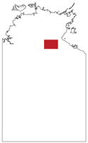
Mount Drummond, Northern Territory : sheet SE5312
-
-
4 files
2000
Tanami : interpreted geology, Northern Territory : sheet SE5215
-
-
2 files
2014
Calvert Hills, Northern Territory : sheet SE5308
-
-
4 files
2014
Delamere, Northern Territory : sheet SD5216
-
-
3 files
1975
Tanami, Northern Territory : sheet SE5215
-
-
4 files
2005
Avon Downs , Northern Territory : sheet SF5304
-
-
3 files
1995
Hermannsburg, Northern Territory : sheet SF5313
-
-
3 files
1995
Mount Doreen : interpreted geology, Northern Territory : sheet SF5212
-
-
2 files
1967
Bloods Range , Northern Territory: sheet SG5203
-
-
3 files
2005
Ranken, Northern Territory : sheet SF5304
-
-
4 files
2014
Limbunya, Northern Territory : sheet SE5207
-
-
3 files
2000
Northwestern Musgrave Block special: interpreted geology, Northern Territory
-
-
2 files
2008
Lander River : interpreted geology, Northern Territory : sheet SF5301
-
-
2 files
2015
Waterloo, Northern Territory : sheet SE5203
-
-
3 files
2005
Mount Evelyn, Northern Territory : sheet SD5305
-
-
3 files
1972
Port Keats, Northern Territory : sheet SD5211
-
-
3 files
1985
Illogwa Creek , Northern Territory : sheet SF5315
-
-
3 files
2006
Highland Rocks : interpreted geology, Northern Territory : sheet SF5207
-
-
2 files
2004
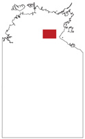
Mount Rennie, Northern Territory : sheet SF5215
-
-
3 files
1982
Napperby , Northern Territory : sheet SF5309
-
-
3 files
Results 1-50 of 109 (Search time: 0.002 seconds).
previous
1
2
3
next
Discover
Document Type
101
GIS Data
15
Interpreted Geology Map
Geological Province
2
Aileron Province
17
Amadeus Basin
6
Arafura Basin
25
Arunta Region
14
Birrindudu Basin
4
Bonaparte Basin
2
Canning Basin
15
Carpentaria Basin
8
Daly Basin
3
Davenport Province
.
next >
Map 250
1
Alcoota SF5310
1
Alice Springs SF5314
1
Alligator River SD5301
2
Alroy SE5315
2
Arnhem Bay SD5303
.
next >
Map 100
1
Amungee Mungee 5764
1
Anburla 5551
1
Andado 5947
1
Angas 5347
1
Annie Creek 5871
.
< previous
next >
Year
2
2020 - 2029
16
2010 - 2019
30
2000 - 2009
18
1990 - 1999
9
1980 - 1989
15
1970 - 1979
19
1963 - 1969