Skip navigation
Home
Browse
Collections
Browse Items by:
Corporate Author
Author
Title Holder/Company
Subject
1:100k mapsheet
1:250k mapsheet
Drillhole
Geological Province
Mine or Prospect
Document Type
Map Scale
Bottom Hole Formation
Survey Name
Stratigraphic Name
Contact Us
Download
Request
Help
Sign on to:
GEMIS
Receive email
updates
Edit Profile
GEMIS
Search
Search:
All Collections
NTGS Products
Reports, Records, Books
for
Current filters:
Report ID
Document Type
Author
Title
Drillhole
Mine or Prospect
Subject
Title Holder/Company
Abstract
Tenure
Stratigraphy
GIS version
Geological Province
Map250
Map100
Year
Collection
Publisher
Date Added
Equals
Contains
ID
Not Equals
Not Contains
Not ID
Start a new search
Add filters:
Use filters to refine the search results.
Report ID
Document Type
Author
Title
Drillhole
Mine or Prospect
Subject
Title Holder/Company
Abstract
Tenure
Stratigraphy
GIS version
Geological Province
Map250
Map100
Year
Collection
Publisher
Date Added
Equals
Contains
ID
Not Equals
Not Contains
Not ID
Results 1-10 of 20 (Search time: 0.002 seconds).
previous
1
2
next
Item hits:
Year
Title
Title Holder/Company
Report id
Preview
Download
2021
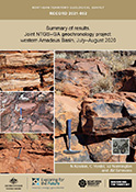
Summary of results. Joint NTGS-GA geochronology project: western Amadeus Basin, July-August 2020
-
NTGS Record 2021-002
1 file
2020
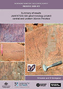
Summary of results. Joint NTGS-GA geochronology project: central and western Aileron Province
-
NTGS Record 2020-011
1 file
2021
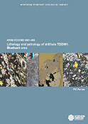
Lithology and petrology of drillhole TDD001, Bluebush area, Warramunga Province
-
NTGS Record 2021-006
1 file
2020
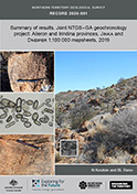
Summary of results. Joint NTGS-GA geochronology project: Aileron and Irindina provinces, Jinka and Dneiper 1:100 000 mapsheets, 2019
-
NTGS Record 2020-001
1 file
2021
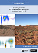
Summary of results. NTGS LA-ICP-MS Hf program: Amadeus Basin, 2015
-
NTGS Record 2021-009
1 file
2021
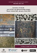
Summary of results. Joint NTGS-GA geochronology project: Rover mineral field, Warramunga Province, January-June 2020
-
NTGS Record 2021-003
1 file
2021
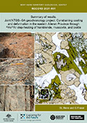
Summary of results. Joint NTGS-GA geochronology project: constraining cooling and deformation in the eastern Aileron Province through 40Ar/39Ar step-heating of hornblende, muscovite, and biotite
-
NTGS Record 2021-001
1 file
2020
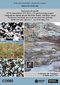
NTGS laser ablation ICP-MS U-Pb geochronology project: Habgood and Balma groups (McArthur Basin), Namerinni Group (Tomkinson Province), and unnamed units from drillholes NDW12-01 and Jamison-1, July 2016-May 2019
-
NTGS Record 2020-009
1 file
2021
Summary of results. Laser ablation ICP-MS in situ apatite geochronology of the Molyhil tungsten-molybdenum deposit and Prospect D nickel-copper prospect
-
NTGS Record 2021-007
1 file
2020
Sulfide δ34S composition of Palaeoproterozoic mineralisation in the Aileron Province, central Australia: an igneous sulfur source?
-
NTGS Record 2020-005
1 file
Discover
Collection
20
Reports, Records, Books
Document Type
20
NTGS Record
Geological Province
9
Aileron Province
6
Amadeus Basin
8
Arunta Region
2
Beetaloo Sub-basin
1
Birrindudu Basin
1
Georgina Basin
2
Irindina Province
3
McArthur Basin
3
Tennant Region
1
Tomkinson Province
.
next >
Map 250
2
Bauhinia Downs SE5303
3
Bloods Range SG5203
2
Blue Mud Bay SD5307
2
Bonney Well SF5302
1
Daly Waters SE5301
.
< previous
next >
Map 100
1
Arnhem 6173
1
Billiatt 5558
1
Blue Mud Bay 6070
2
Chaluba 5657
1
Charlotte 5648
.
next >
Year
9
2021
11
2020