Skip navigation
Home
Browse
Collections
Browse Items by:
Corporate Author
Author
Title Holder/Company
Subject
1:100k mapsheet
1:250k mapsheet
Drillhole
Geological Province
Mine or Prospect
Document Type
Map Scale
Bottom Hole Formation
Survey Name
Stratigraphic Name
Contact Us
Download
Request
Help
Sign on to:
GEMIS
Receive email
updates
Edit Profile
GEMIS
Search
Search:
All Collections
NTGS Products
Reports, Records, Books
for
Current filters:
Report ID
Document Type
Author
Title
Drillhole
Mine or Prospect
Subject
Title Holder/Company
Abstract
Tenure
Stratigraphy
GIS version
Geological Province
Map250
Map100
Year
Collection
Publisher
Date Added
Equals
Contains
ID
Not Equals
Not Contains
Not ID
Report ID
Document Type
Author
Title
Drillhole
Mine or Prospect
Subject
Title Holder/Company
Abstract
Tenure
Stratigraphy
GIS version
Geological Province
Map250
Map100
Year
Collection
Publisher
Date Added
Equals
Contains
ID
Not Equals
Not Contains
Not ID
Start a new search
Add filters:
Use filters to refine the search results.
Report ID
Document Type
Author
Title
Drillhole
Mine or Prospect
Subject
Title Holder/Company
Abstract
Tenure
Stratigraphy
GIS version
Geological Province
Map250
Map100
Year
Collection
Publisher
Date Added
Equals
Contains
ID
Not Equals
Not Contains
Not ID
Results 1-10 of 12 (Search time: 0.002 seconds).
previous
1
2
next
Item hits:
Year
Title
Title Holder/Company
Report id
Preview
Download
2000
Carbonatites and related mineral deposits
-
NTGS Record 2000-015
1 file
2000
Tanami Region geochemical dataset
-
NTGS Record 2000-014
1 file
2000
Operations and processing report, South Lake Woods airborne survey, NTGS 1999 (flown by Kevron Geophysics, covering parts of South Lake Woods, Newcastle Waters and Beetaloo 1:250 000 map sheets)
-
NTGS Record 2000-003
1 file
2000
Operations and logistics report, Mt Doreen, Mt Liebig and Mackay/Rennie airborne geophysical survey, NTGS 1998 (flown by AGS)
-
NTGS Record 2000-008
1 file
2000
Operations and processing report, Bonney Well airborne survey, NTGS 1999 (flown by AGS, covering parts of Bonney Well, Lander River and Frew River 1:250 000 map sheets)
-
NTGS Record 2000-005
1 file
2000
Operations and processing report, Amadeus West airborne geophysical survey, NTGS 1999 (flown by AGS covering parts of Bloods Range, Lake Amadeus, Henbury, Mount Rennie and Mount Liebig 1:250 000 map sheets)
-
NTGS Record 2000-004
1 file
2000
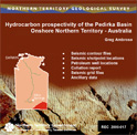
Hydrocarbon prospectivity of the Pedirka Basin, onshore Northern Territory
-
NTGS Record 2000-017
1 file
2000
Palaeoproterozoic stratigraphy of the Tanami region
-
NTGS Record 2000-013
1 file
2000
Structure of the Woodcutters open pit and implications for mineralisation models
-
NTGS Record 2000-011
1 file
2000
Operations and processing report, Victoria River Downs airborne geophysical survey, NTGS 1998 (flown by Kevron Geophysics, covering parts of Auvergne, Delamere, Waterloo and Victoria River Downs 1:250 000 map sheets)
-
NTGS Record 2000-009
1 file
Discover
Collection
12
Reports, Records, Books
Document Type
12
NTGS Record
1
GIS Data
Geological Province
1
Arunta Region
1
Birrindudu Basin
1
Carpentaria Basin
1
McArthur Basin
1
Murphy Inlier
1
Ngalia Basin
1
Pedirka Basin
2
Pine Creek Orogen
1
Victoria Basin
2
Wiso Basin
.
next >
Map 250
1
Auvergne SD5215
1
Beetaloo SE5306
1
Bloods Range SG5203
1
Bonney Well SF5302
1
Calvert Hills SE5308
.
next >
Map 100
1
Noonamah 5172
1
Seigal 6462