Skip navigation
Home
Browse
Collections
Browse Items by:
Corporate Author
Author
Title Holder/Company
Subject
1:100k mapsheet
1:250k mapsheet
Drillhole
Geological Province
Mine or Prospect
Document Type
Map Scale
Bottom Hole Formation
Survey Name
Stratigraphic Name
Contact Us
Download
Request
Help
Sign on to:
GEMIS
Receive email
updates
Edit Profile
GEMIS
Search
Search:
All Collections
NTGS Products
AGES abstracts and other papers
Digital Information Packages
Geophysical and Remote Sensing Data
HyLogger Data
Maps and Explanatory Notes
Reports, Records, Books
for
Current filters:
Report ID
Document Type
Author
Title
Drillhole
Mine or Prospect
Subject
Title Holder/Company
Abstract
Tenure
Stratigraphy
GIS version
Geological Province
Map250
Map100
Year
Collection
Publisher
Date Added
Equals
Contains
ID
Not Equals
Not Contains
Not ID
Report ID
Document Type
Author
Title
Drillhole
Mine or Prospect
Subject
Title Holder/Company
Abstract
Tenure
Stratigraphy
GIS version
Geological Province
Map250
Map100
Year
Collection
Publisher
Date Added
Equals
Contains
ID
Not Equals
Not Contains
Not ID
Start a new search
Add filters:
Use filters to refine the search results.
Report ID
Document Type
Author
Title
Drillhole
Mine or Prospect
Subject
Title Holder/Company
Abstract
Tenure
Stratigraphy
GIS version
Geological Province
Map250
Map100
Year
Collection
Publisher
Date Added
Equals
Contains
ID
Not Equals
Not Contains
Not ID
Results 1-10 of 56 (Search time: 0.002 seconds).
previous
1
2
3
4
...
6
next
Item hits:
Year
Title
Title Holder/Company
Report id
Preview
Download
2021
Summary of results. Joint NTGS-GA geochronology project: constraining cooling and deformation in the eastern Aileron Province through 40Ar/39Ar step-heating of hornblende, muscovite, and biotite
-
NTGS Record 2021-001
1 file
2021
CSIRO-NTGS McArthur Basin Project: analysis and interpretation of historical AEM data sets
-
DIP033
3 files
2021
Warramunga Province Deposit Atlas program: an update
-
-
2 files
2021
Summary of results. Joint NTGS-GA geochronology project: Rover mineral field, Warramunga Province, January-June 2020
-
NTGS Record 2021-003
1 file
2021
The Rover field: insights on stratigraphy, age and base metal mineralisation
-
-
2 files
2021
Petroleum geology and geochemistry of the Birrindudu Basin, greater McArthur Basin
-
-
2 files
2021
Geophysical interpretation of the Tanami Region, northern Aileron and southwest Davenport provinces
-
-
1 file
2021
Kalkarindji through the geophysical lens: structural characteristics of the Kalkarindji basalt from non-seismic geophysical data
-
-
2 files
2021
Summary of results. NTGS LA-ICP-MS Hf program: Amadeus Basin, 2015
-
NTGS Record 2021-009
1 file
2021
West Amadeus Basin, Northern Territory : explanatory notes
-
-
1 file
Discover
Collection
27
AGES abstracts and other papers
7
Digital Information Packages
10
HyLogger Data
3
Maps and Explanatory Notes
9
Reports, Records, Books
Document Type
26
Presentation
23
AGES Abstract
10
NTGS Record
7
GIS Data
7
NTGS Digital Information Package
6
Processed HyLogger data
4
HyLogger Data Package
2
Regional Map
1
Conference Proceedings
1
Explanatory Note
.
next >
Geological Province
14
Aileron Province
8
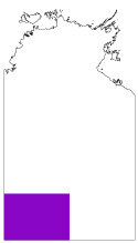
Amadeus Basin
2
Arnhem Province
14
Arunta Region
8
Beetaloo Sub-basin
4
Birrindudu Basin
2
Canning Basin
2
Davenport Province
1
Georgina Basin
5
Kalkarindji Province
.
next >
Map 250
1
Alcoota SF5310
7
Alroy SE5315
1
Auvergne SD5215
2
Ayers Rock SG5208
2
Barrow Creek SF5306
.
next >
Map 100
3
Alroy 6159
1
Barkly 5859
2
Billiatt 5558
1
Bonney 5757
1
Buck 4958
.
next >