Skip navigation
Home
Browse
Collections
Browse Items by:
Corporate Author
Author
Title Holder/Company
Subject
1:100k mapsheet
1:250k mapsheet
Drillhole
Geological Province
Mine or Prospect
Document Type
Map Scale
Bottom Hole Formation
Survey Name
Stratigraphic Name
Contact Us
Download
Request
Help
Sign on to:
GEMIS
Receive email
updates
Edit Profile
GEMIS
Search
Search:
All Collections
NTGS Products
AGES abstracts and other papers
Digital Information Packages
Geophysical and Remote Sensing Data
HyLogger Data
Maps and Explanatory Notes
Reports, Records, Books
for
Current filters:
Report ID
Document Type
Author
Title
Drillhole
Mine or Prospect
Subject
Title Holder/Company
Abstract
Tenure
Stratigraphy
GIS version
Geological Province
Map250
Map100
Year
Collection
Publisher
Date Added
Equals
Contains
ID
Not Equals
Not Contains
Not ID
Report ID
Document Type
Author
Title
Drillhole
Mine or Prospect
Subject
Title Holder/Company
Abstract
Tenure
Stratigraphy
GIS version
Geological Province
Map250
Map100
Year
Collection
Publisher
Date Added
Equals
Contains
ID
Not Equals
Not Contains
Not ID
Start a new search
Add filters:
Use filters to refine the search results.
Report ID
Document Type
Author
Title
Drillhole
Mine or Prospect
Subject
Title Holder/Company
Abstract
Tenure
Stratigraphy
GIS version
Geological Province
Map250
Map100
Year
Collection
Publisher
Date Added
Equals
Contains
ID
Not Equals
Not Contains
Not ID
Results 1-10 of 56 (Search time: 0.002 seconds).
previous
1
2
3
4
...
6
next
Item hits:
Year
Title
Title Holder/Company
Report id
Preview
Download
2021
HyLogger drillhole report for RNRCD029, 'Anomaly 11', Pine Creek Orogen, Northern Territory
-
HDP0105
1 file
2021
Results from the MinEx CRC National Drilling Initiative campaign in East Tennant: What's there and why you should care
-
-
2 files
2021
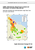
Northern Territory SEEBASE and GIS
-
DIP030
3 files
2021
Epigenetic copper and tungsten mineralisation in the northeastern Aileron Province, central Australia
-
-
2 files
2021
Summary of results. Joint NTGS-GA geochronology project: western Amadeus Basin, July-August 2020
-
NTGS Record 2021-002
1 file
2021
The Exploring for the Future 2019 Barkly 2D Deep Crustal Reflection Seismic Survey: key discoveries and implication for resources
-
-
2 files
2021
The Rover field: insights on stratigraphy, age and base metal mineralisation
-
-
2 files
2021
CSIRO-NTGS McArthur Basin Project: analysis and interpretation of historical AEM data sets
-
DIP033
3 files
2021
West Amadeus Basin, Northern Territory : explanatory notes
-
-
1 file
2021
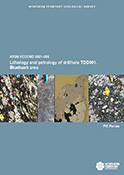
Lithology and petrology of drillhole TDD001, Bluebush area, Warramunga Province
-
NTGS Record 2021-006
1 file
Discover
Collection
27
AGES abstracts and other papers
7
Digital Information Packages
10
HyLogger Data
3
Maps and Explanatory Notes
9
Reports, Records, Books
Document Type
1
Interpreted Geology Map
.
< previous
Geological Province
14
Aileron Province
8
Amadeus Basin
2
Arnhem Province
14
Arunta Region
8
Beetaloo Sub-basin
4
Birrindudu Basin
2
Canning Basin
2
Davenport Province
1
Georgina Basin
5
Kalkarindji Province
.
next >
Map 250
1
Alcoota SF5310
7
Alroy SE5315
1
Auvergne SD5215
2
Ayers Rock SG5208
2
Barrow Creek SF5306
.
next >
Map 100
3
Alroy 6159
1
Barkly 5859
2
Billiatt 5558
1
Bonney 5757
1
Buck 4958
.
next >