Skip navigation
Home
Browse
Collections
Browse Items by:
Corporate Author
Author
Title Holder/Company
Subject
1:100k mapsheet
1:250k mapsheet
Drillhole
Geological Province
Mine or Prospect
Document Type
Map Scale
Bottom Hole Formation
Survey Name
Stratigraphic Name
Contact Us
Download
Request
Help
Sign on to:
GEMIS
Receive email
updates
Edit Profile
GEMIS
Search
Search:
All Collections
NTGS Products
AGES abstracts and other papers
Digital Information Packages
Geophysical and Remote Sensing Data
HyLogger Data
Maps and Explanatory Notes
Reports, Records, Books
for
Current filters:
Report ID
Document Type
Author
Title
Drillhole
Mine or Prospect
Subject
Title Holder/Company
Abstract
Tenure
Stratigraphy
GIS version
Geological Province
Map250
Map100
Year
Collection
Publisher
Date Added
Equals
Contains
ID
Not Equals
Not Contains
Not ID
Start a new search
Add filters:
Use filters to refine the search results.
Report ID
Document Type
Author
Title
Drillhole
Mine or Prospect
Subject
Title Holder/Company
Abstract
Tenure
Stratigraphy
GIS version
Geological Province
Map250
Map100
Year
Collection
Publisher
Date Added
Equals
Contains
ID
Not Equals
Not Contains
Not ID
Results 1-10 of 136 (Search time: 0.001 seconds).
previous
1
2
3
4
...
14
next
Item hits:
Year
Title
Title Holder/Company
Report id
Preview
Download
2020
Tanami Region: reprocessing, interpretation and modelling of newly acquired and legacy geophysical data
-
-
1 file
2020
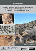
Summary of results. Joint NTGS-GA geochronology project: Aileron and Irindina provinces, Jinka and Dneiper 1:100 000 mapsheets, 2019
-
NTGS Record 2020-001
1 file
2020
We get rocked down but we get up again: learnings from Kyalla 117 N2-1
-
-
1 file
2020
Ediacaran stratigraphic correlations in the western Amadeus Basin, central Australia
-
-
2 files
2020
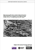
Warramunga Province mineral deposit series: White Devil 3D compilation and deposit atlas
-
DIP027
3 files
2020
East Tennant : gravity survey
-
-
2021
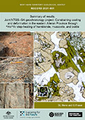
Summary of results. Joint NTGS-GA geochronology project: constraining cooling and deformation in the eastern Aileron Province through 40Ar/39Ar step-heating of hornblende, muscovite, and biotite
-
NTGS Record 2021-001
1 file
2021
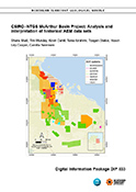
CSIRO-NTGS McArthur Basin Project: analysis and interpretation of historical AEM data sets
-
DIP033
3 files
2020
The Tennant Creek mineral field and Rover fields: Many similarities but some important differences
-
-
1 file
2021
Warramunga Province Deposit Atlas program: an update
-
-
2 files
Discover
Collection
56
AGES abstracts and other papers
13
Digital Information Packages
7
Geophysical and Remote Sensing Data
34
HyLogger Data
6
Maps and Explanatory Notes
20
Reports, Records, Books
Document Type
50
AGES Abstract
35
Presentation
28
HyLogger Data Package
22
NTGS Record
14
GIS Data
13
NTGS Digital Information Package
6
Airborne Magnetic and Radiometric...
6
Processed HyLogger data
3
Gravity Survey
2
Conference Proceedings
.
next >
Geological Province
20
Pine Creek Orogen
15
South Nicholson Basin
21
Tanami Region
38
Tennant Region
2
Tomkinson Province
35
Warramunga Province
8
Wiso Basin
.
< previous
Map 250
1
Alcoota SF5310
1
Alice Springs SF5314
4
Alligator River SD5301
8
Alroy SE5315
1
Arnhem Bay SD5303
.
next >
Map 100
3
Alroy 6159
2
Anningie 5554
1
Arapunga 6053
1
Arnhem 6173
1
Barkly 5859
.
next >
Year
56
2021
80
2020