Skip navigation
Home
Browse
Collections
Browse Items by:
Corporate Author
Author
Title Holder/Company
Subject
1:100k mapsheet
1:250k mapsheet
Drillhole
Geological Province
Mine or Prospect
Document Type
Map Scale
Bottom Hole Formation
Survey Name
Stratigraphic Name
Contact Us
Download
Request
Help
Sign on to:
GEMIS
Receive email
updates
Edit Profile
GEMIS
Search
Search:
All Collections
NTGS Products
AGES abstracts and other papers
Digital Information Packages
Geophysical and Remote Sensing Data
HyLogger Data
Maps and Explanatory Notes
Reports, Records, Books
for
Current filters:
Report ID
Document Type
Author
Title
Drillhole
Mine or Prospect
Subject
Title Holder/Company
Abstract
Tenure
Stratigraphy
GIS version
Geological Province
Map250
Map100
Year
Collection
Publisher
Date Added
Equals
Contains
ID
Not Equals
Not Contains
Not ID
Report ID
Document Type
Author
Title
Drillhole
Mine or Prospect
Subject
Title Holder/Company
Abstract
Tenure
Stratigraphy
GIS version
Geological Province
Map250
Map100
Year
Collection
Publisher
Date Added
Equals
Contains
ID
Not Equals
Not Contains
Not ID
Start a new search
Add filters:
Use filters to refine the search results.
Report ID
Document Type
Author
Title
Drillhole
Mine or Prospect
Subject
Title Holder/Company
Abstract
Tenure
Stratigraphy
GIS version
Geological Province
Map250
Map100
Year
Collection
Publisher
Date Added
Equals
Contains
ID
Not Equals
Not Contains
Not ID
Results 21-30 of 58 (Search time: 0.002 seconds).
previous
1
2
3
4
5
6
next
Item hits:
Year
Title
Title Holder/Company
Report id
Preview
Download
2018
Neoproterozoic stratigraphic revisions to key drillholes in the Amadeus Basin - implications for basin palaeogeography and petroleum and minerals potential
-
-
2 files
2018
Interpretation-ready Kingdom seismic project - Beetaloo Sub-basin
-
DIP019
3 files
2018
Batten Fault Zone : gravity survey
-
-
2 files
2018
Revised stratigraphy of drillholes CPDD001, CPDD002 and CPDD003, Pipeline Prospect, northeast Amadeus Basin
-
NTGS Record 2017-015
1 file
2018
Exploring for the Future opportunities beneath the Tennant Creek-Mount Isa (TISA) region
-
-
2 files
2018
SEEBASE Study and GIS for greater McArthur Basin: Supplementary Data
-
DIP018
4 files
2018
Newmont Tanami Operations: Multiple new discoveries supporting transformational growth in a mature mining camp
-
-
2 files
2018
Summary of results. NTGS laser ablation ICP-MS U-Pb and Lu-Hf geochronology project: Roper Group (McArthur Basin), overlying ungrouped units (Beetaloo Sub-basin), Renner Group (Tomkinson Province), and Tijunna Group (Birrindudu Basin)
-
NTGS Record 2018-007
1 file
2018
Seismic shift in regional Neoproterozoic correlation, Amadeus Basin, central Australia
-
-
2 files
2018
Revised Neoproterozoic stratigraphy in the Mount Conner area, Amadeus Basin, Northern Territory
-
NTGS Record 2018-008
1 file
Discover
Collection
29
AGES abstracts and other papers
3
Digital Information Packages
2
Geophysical and Remote Sensing Data
6
HyLogger Data
2
Maps and Explanatory Notes
16
Reports, Records, Books
Document Type
26
Presentation
25
AGES Abstract
17
NTGS Record
5
HyLogger Data Package
3
GIS Data
3
NTGS Digital Information Package
1
Airborne Magnetic and Radiometric...
1
Conference Proceedings
1
Core Analysis
1
Gravity Survey
.
next >
Geological Province
13
Aileron Province
13
Amadeus Basin
1
Arafura Basin
6
Arnhem Province
11
Arunta Region
8
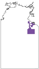
Beetaloo Sub-basin
1
Birrindudu Basin
1
Bonaparte Basin
1
Browse Basin
1
Carpentaria Basin
.
next >
Map 250
2
Alice Springs SF5314
1
Alligator River SD5301
1
Arnhem Bay SD5303
1
Ayers Rock SG5208
2
Bauhinia Downs SE5303
.
next >
Map 100
1
Adam 6451
1
Areyonga 5349
1
Blue Mud Bay 6070
1
Borroloola 6165
1
Caledon 6272
.
next >