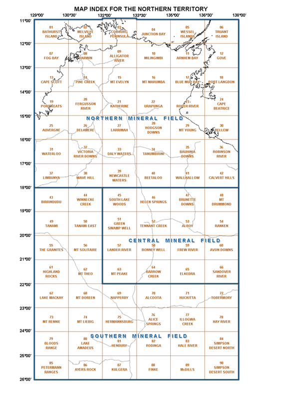

The Northern Territory's exploration and mining titles are administered by the Titles Division of the Department of Primary Industry & Resources (DPIR). The Division manages the Title Register and associated map reference data which displays all exploration and mining titles in the Northern Territory.
From the early 1960's to 1 January 2000 paper maps of various scales were updated daily with new applications, grants, reductions and cessations of titles. Periodically, these map sheets were replaced as their line work became congested and difficult to read. The "busier" an area was, the more often its map sheet had to be replaced. These replaced maps were then sent to the Minerals and Energy InfoCentre to be catalogued. There are now in excess of 6200 mining tenement map sheets in the possession of the InfoCentre. In late 2001 these map sheets were scanned at 300 dpi in full colour.
The images are available for viewing by clicking on the Territory Map to the left. Copies of the digital map series can also be obtained from the Minerals and Energy InfoCentre in either ECW or JPG formats on CD-ROMs. In usage in GIS environments, please note that these images are not spatially referenced.
The Spatial Territory Resource Information Kit for Exploration (STRIKE) is the Department of Primary Industry and Resources web mapping application for the efficient delivery of tenure and geoscientific information for both industry and government users.
STRIKE can be accessed from https://strike.nt.gov.au
Before you access the map images by clicking on the above Territory map, please read the following information:
After selecting the map that you are interested in, you will be presented with a table, listing the available images for that region.
'x' indicates the scale of the map captured in the image (see above example).
The purpose of the Date field is to give an approximate chronological order to the maps that are available in the area of your interest. This date reflects one of the following three possibilities:

This option will enable the browser of your computer to view the images, and will enable you to pan around and zoom into an area of your interest. The first time you access the images through this option, you will need to download a plug-in for your Internet Browser. When you click on the image link itself, the download will start automatically. Please follow the on-screen instructions to complete the process. This process will not have to be repeated on subsequent accesses.
To pan, hold down the left mouse button and drag the image. To zoom in, hold down both the left and right mouse buttons at the same time and move the mouse forward (as if moving the pointer on the monitor upwards). To zoom out, hold down both the left and right mouse buttons at the same time and move the mouse backwards (as if moving the pointer on the monitor downwards).

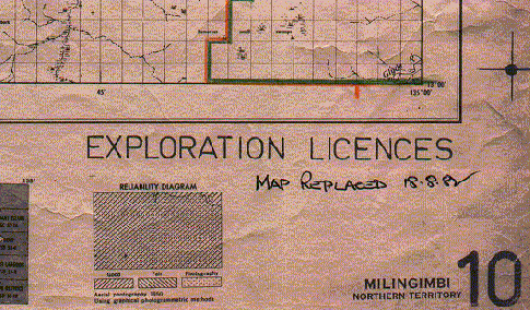
In the above examples, the image that will be loaded, will be of a map at 1:250 000 scale. The date "18/08/1982" appears on the map image meaning that this map was updated from 18 August 1982.